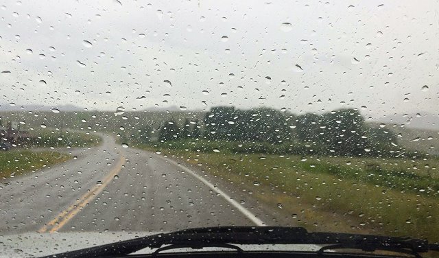
Tuesday July 17: Although we like Divide Bridge Campground along the Big Hole River in southwest Montana, we are on a time schedule and leave fairly early.
Raining as we leave Divide Bridge Campground
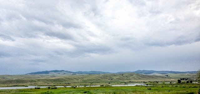
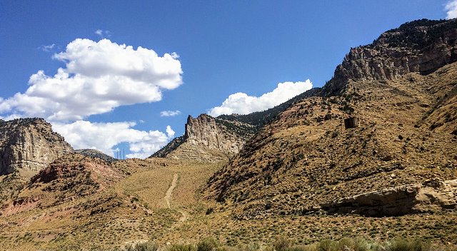
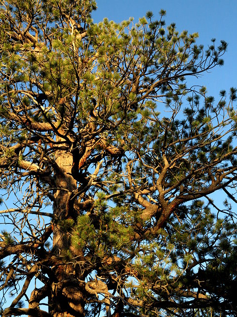
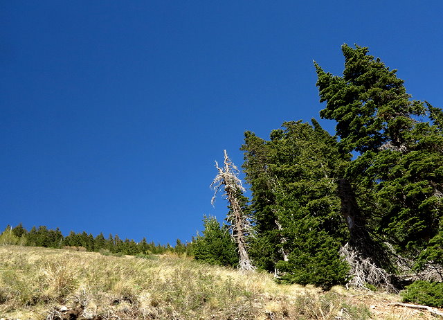
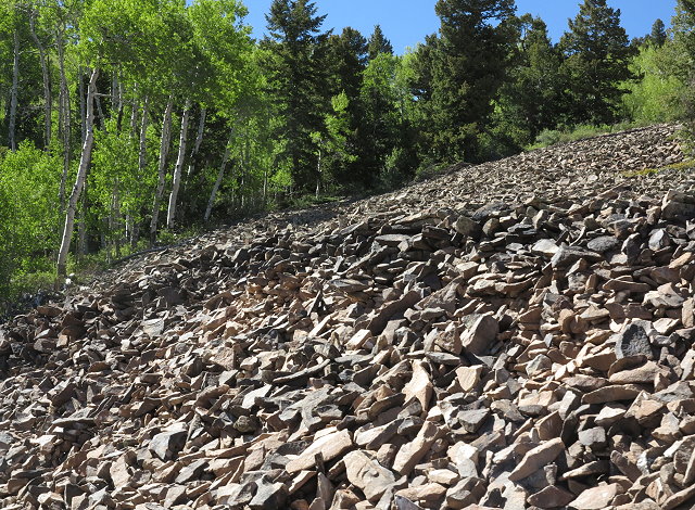
Montana – Big sky, big mountains, big rivers
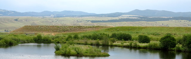
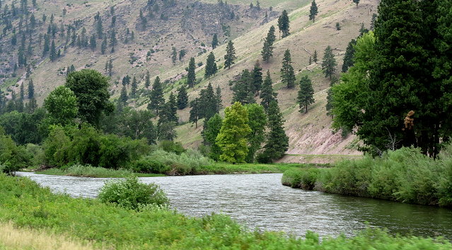
Clarkfork River as we approach Missoula area
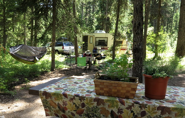
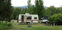
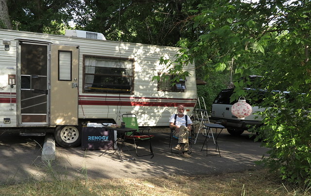
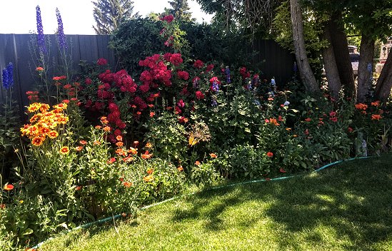
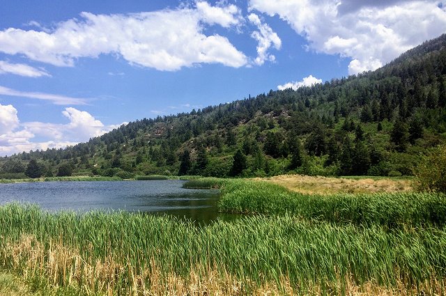
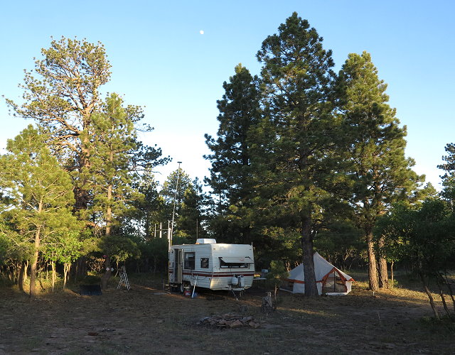
We arrive at the Lolo Creek Campground north of Lolo, Montana, about mid-afternoon. This is a great location, relatively close to siblings in the Bitterroot Valley and kids on the west side of Missoula, as well as friends in Missoula. The drawback is that there is no cell service, so we have to drive back to Lolo to let everyone know we are here and begin making plans for getting together.
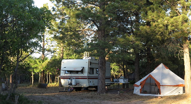
This is home at Lolo Creek Campground
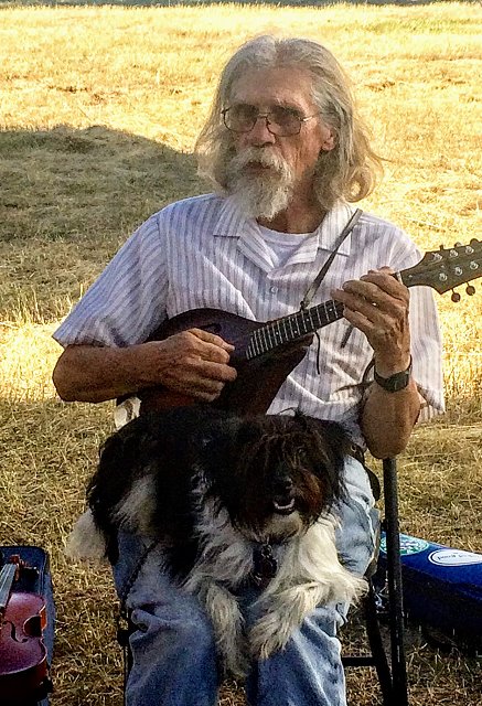
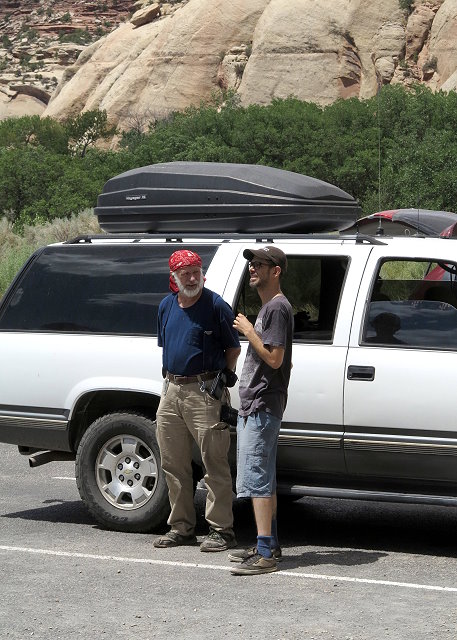
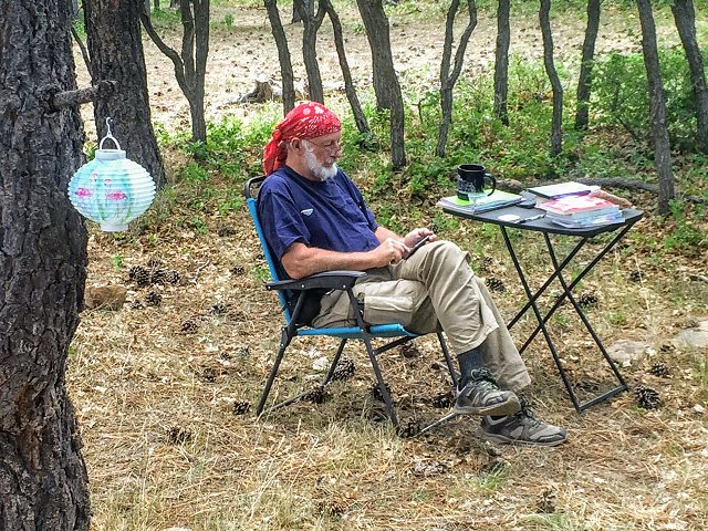
Later, my brother Rollie and his pal Ninja drive up to see us and we play music – first time together since March. Since we are going to be doing a “gig”in a few days, some practice time together is a good idea.
Rollie and Ninja play the mandolin
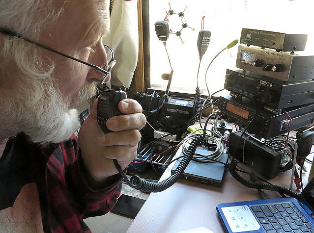
We share a late dinner and I wrap up the day with the usual evening routine of reading, journal writing, and so on. Clifford works with his ham radio since we will be here long enough for him to set up his big antennas.
Happy to be here, happy to be in Montana, and soon I’ll be seeing my kids and my other siblings. Montana, here we are!
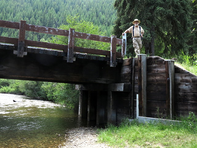
Wednesday July 18: Today is a day of settling into our spot, as we will be here for two weeks. We walk to Lolo Creek, just a short ways away, but other than that, we hang around camp, enjoying a relaxing day.
Clifford on the bridge over Lolo Creek near the campground
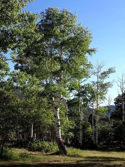
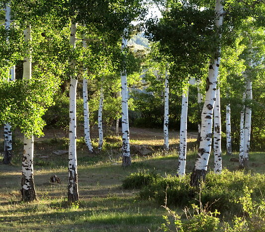
Lolo Creek – western Montana
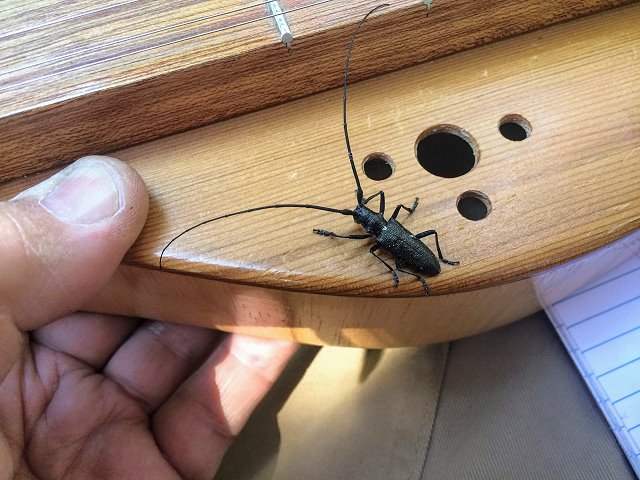
Clifford is focused on his ham radio communications and playing his dulcimer. I finish getting the inside of Terry set up, read, and write in my journal, having gotten behind while traveling.
A big bug joins Clifford on the dulcimer
In the afternoon, my brother Rollie comes out to play music and have dinner with us. A peaceful day, and it sure feels good to know that we do not to have to pack and be on the road in the morning.
Thursday July 12: Today we are leaving for Montana. I have spent several days getting the camper packed and things ready for us to leave, but there are always last-minute things to take care of. Clifford has to pack lab items and he has a call with a CI consultant. It is 4:00 in the afternoon before we are finally on our way.
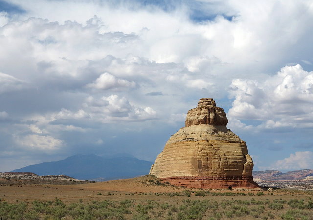
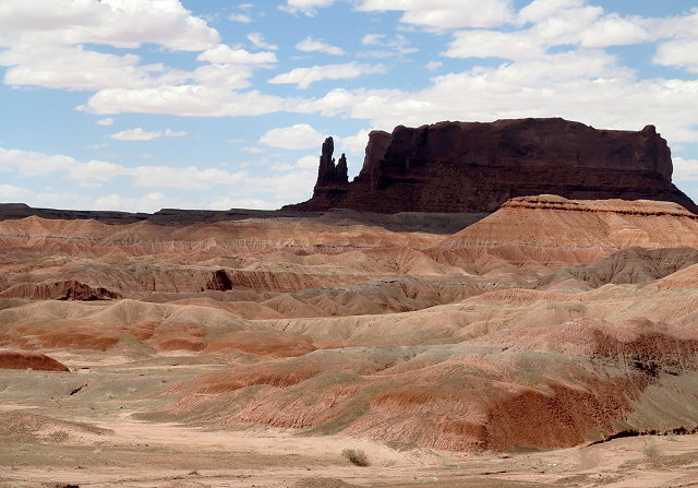
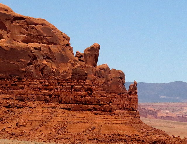
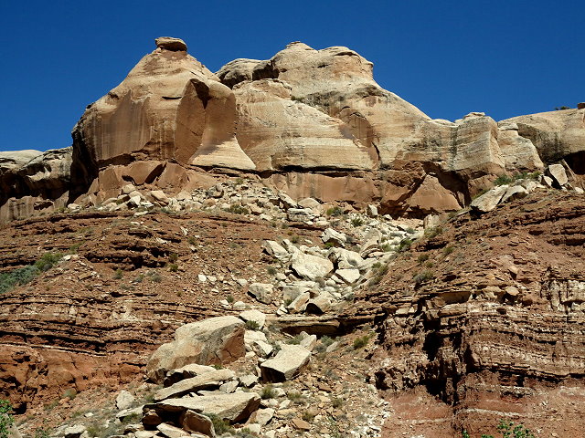
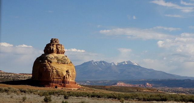
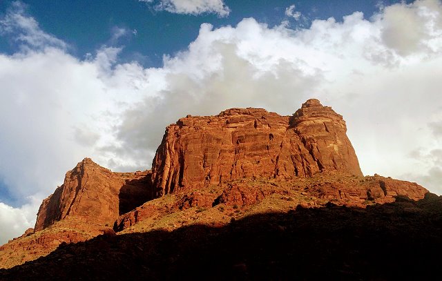
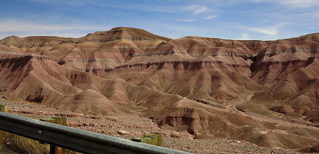
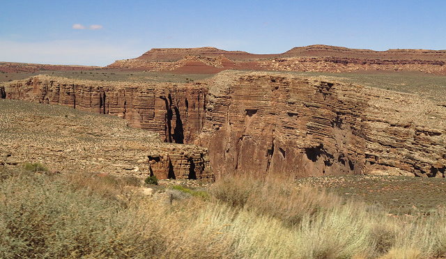
Castle Rock north of Monticello on Highway 191
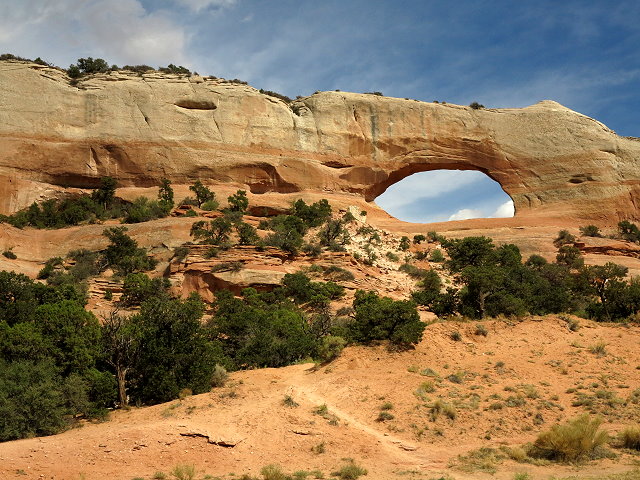
Wilson Arch south of Moab on Highway 191
After a brief stop in Moab, we continue on north. The route between Moab and Price, Utah, being rather barren, is not my favorite part of the state and I’m glad when we reach the Price Walmart where we’ll spend the night. We set up in the back lot with a tree beside us, balancing between the hiss of the street light and the rumble of a semi engine. We pick up a few supplies, then opt for an easy soup dinner tonight.
Friday July 13: We finish stocking up and get a much earlier start today, winding our way through the scenic canyons of Utah south of the Salt Lake City complex.
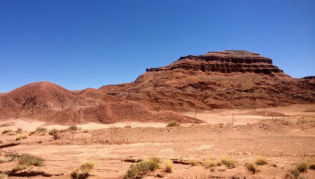
Canyon country north of Price, Utah
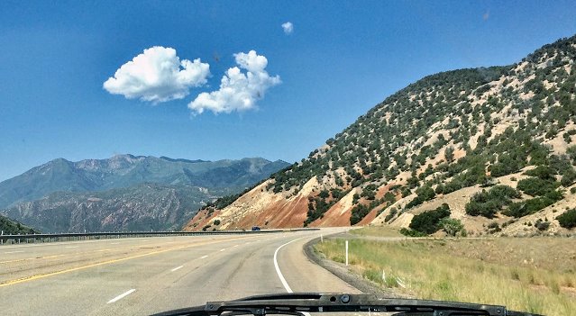
Wasach Range
We arrive at Diamond Campground south of Spanish Forks in early afternoon. Although most spots are taken or reserved, we find a pretty spot with shade and privacy.
It seems quite hot here after having gotten used to the cooler elevation of Monticello. After a tuna sandwich, we take naps, avoiding the pesky bugs for awhile. Later on, we play frisbee, which I’m not very good at, but it was fun. After dinner, I have my usual routine of reading and writing in the journal before bedtime. Clifford always has books to study and his ham radio gear to work with.
Saturday July 14: We are spending the day here at Diamond CG so as to make our run through Salt Lake City on a Sunday morning. It is quite delightful having a day to hang out – reading, writing in the journal, playing viola, playing frisbee and going on a walkabout on the nature path with Clifford – like a real vacation!
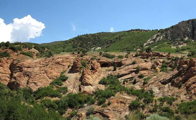
The crest of the hill behind the campground
Sunday July 15: We are up at 8:00, and soon packed and on our way. It does help to get across Salt Lake City on a Sunday morning, but even so, it is my least favorite part of any trips we have made north and south. Sure wish there was some other efficient way to get from Montana to southern Utah.
We arrive in Idaho Falls, Idaho, in the later afternoon and get set up along the stretch of grass and trees bordering the side parking lot at Walmart. After getting a few supplies, we go to Panda Express for dinner, as I am too tired to cook tonight. It is too hot to feel like doing much. This sure would be a good time to have a picnic table in the shade!
Walmart boondocking
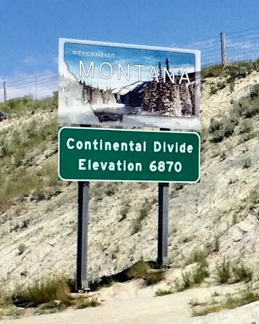
Monday July 16: We leave Idaho Falls about 10:00 a.m. and it is always exciting to cross over into Montana.
We stop in Dillon to see my cousin Bill and his wife Sally. Sally has a small, but gorgeous yard. We can’t stay long, as we need to reach our next camping spot and get set up, but it was nice to see them for a little while.
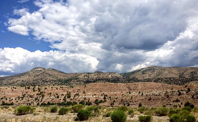
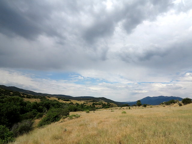
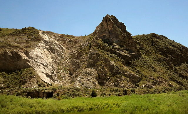
Southwest Montana
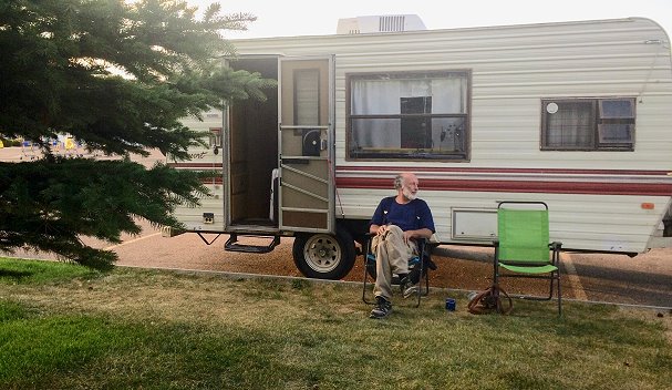
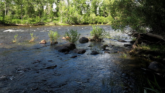
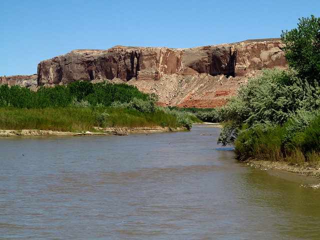
When we reach Divide Bridge Campground, I am excited to see a spot available by the Big Hole River. This is exactly the spot I was hoping for, but when I get out to help guide us in, I find that the mosquitoes are abundant and voracious. So, we drive to the far side of the campground away from the river, but don’t see any spots that we like. The compromise is the row of sites in between the dry side and the river. It is nice here with lawns and shrubs, but not so many mosquitoes. We find a spot with a tree and after getting set up, we sit out at the picnic table with cool drinks.
Camping at Divide Bridge Campground
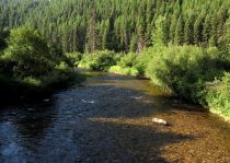
Big Hole River
I am happy to be in Montana, and soon I’ll be seeing my kids and my other siblings. Montana, here we are!
Thursday July 5: Today is a playday for us – Clifford, me, and CI webmaster and friend, Kaylee, who has come up from Albuquerque for a CI board meeting, project planning, and web work. We have been working hard on CI projects this week, but decide to take a day off to show Kaylee the countryside.
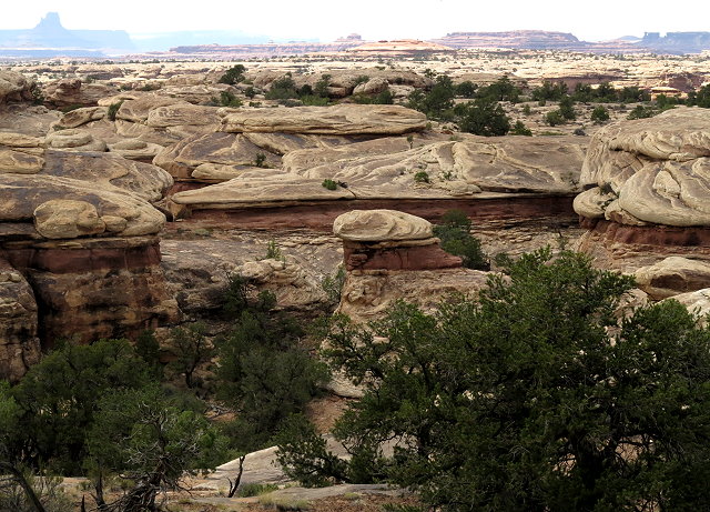
Our destination is the Needles District of Canyonlands National Park, by way of Abajo Mountain. Our first stop is Foy Lake at the crest of the slope we are traversing, as we explore possible camping spots for future reference.
Foy Lake on Abajo Mountain
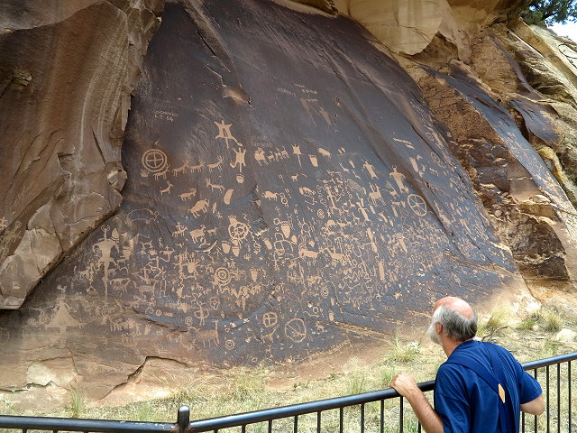
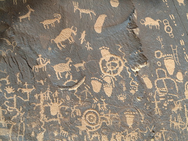
Our next stop is a Utah State Historical Monument, Newspaper Rock, a 200 square foot cliff wall covered with Native American petroglyphs, created by several ancient cultures beginning about 1,500 years ago. The “drawings” consist of animals, human figures, and many inexplicable symbols. In our travels, this is the most dense display of petroglyphs that we have seen.
Newspaper Rock
A close-up of some of the petroglyphs on Newspaper Rock
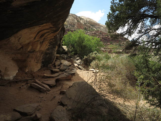
Exploring at Newspaper Rock
Clifford and Kaylee chat as they wait for me to take a few more photos
Continuing on highway 211, the journey includes several miles through canyon land under BLM jurisdiction.
BLM land on the route to Needles District of Canyonlands National Park
BLM land on the route to Needles District of Canyonlands National Park
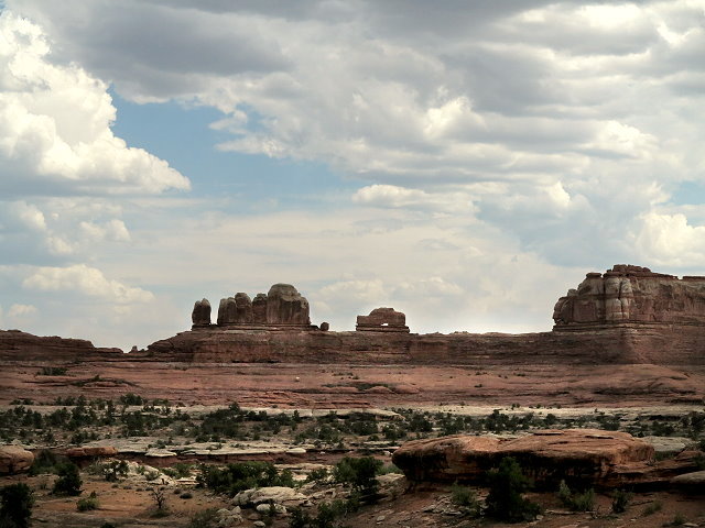
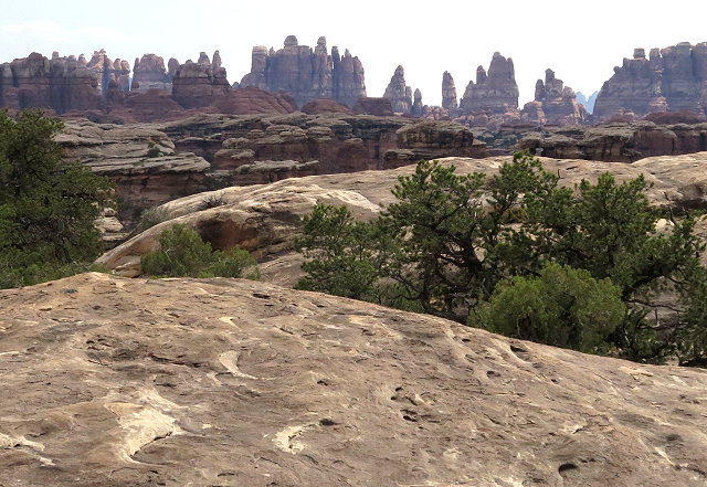
When we arrive at the Needles District Visitors’ Center, we browse briefly, then drive on to view points of interest. Wooden Shoe Arch is a good stop and we linger there a bit.
Wooden Shoe Arch vista point
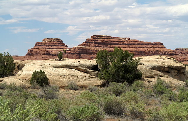
Other views from the Wooden Shoe Arch pullout
Other views from the Wooden Shoe Arch pullout
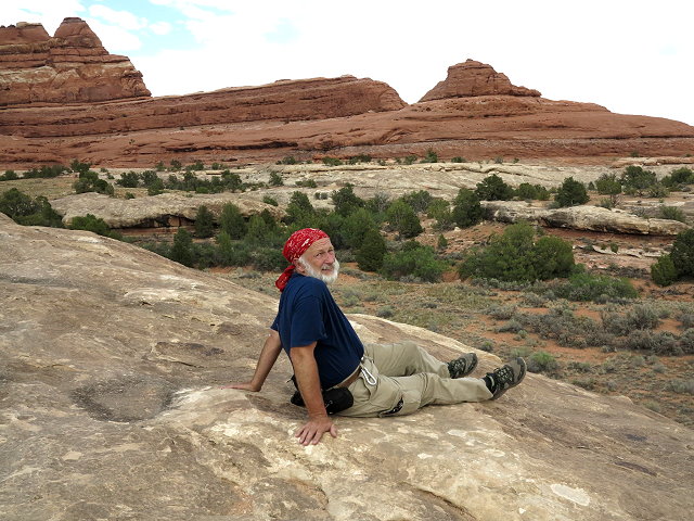
Clifford relaxing at the Wood Shoe Arch pullout
Kaylee enjoying the views at the Wooden Shoe Arch pullout
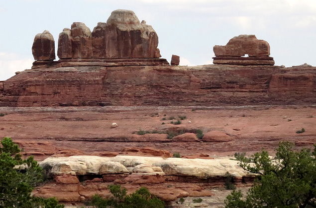
At Pothole Point, we hike the loop trail, which offers views of the remarkable landscape in this part of the park. On the way back, there is a better pullout from which to see the Wooden Shoe Arch, even though it is not marked as such.
Pothole Point scenic hiking loop
Pothole Point scenic hiking loop
Carol on the Pothole Point scenic hiking loop
Badland views from Pothole Point scenic hiking loop
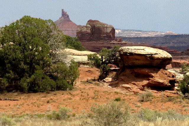
View of the Needles District from the Pothole Point scenic hiking loop
A closer view of Wooden Shoe Arch
Back at home, I download the photos of the day. We visit after dinner, bed time is late, but we all had a very good day, a refreshing break before we carry on with CI business tomorrow.
Thursday June 21: We are heading up Abajo Mountain today to Pine Flats, a dispersed area beyond the campgrounds, and setting up for Amateur Radio Field Day 2018. Leaving the paved highway, the road into Pine Flats is terrible, with deep ruts some places, rough and rocky in other spots. We had checked out this area last fall, so we have an idea of the layout. Creeping along at two miles an hour, we make our way to the branch that we’d like to take. We walk in first to make sure the road is passable and the spot free. Hooray, we are good to go, so continue creeping to a group of pine trees beyond a stand of aspens. The pine trees ofter shade and the aspens offer their graceful beauty.
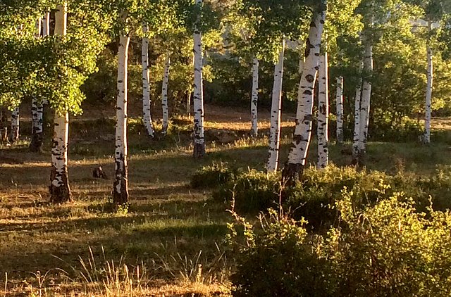
Aspens add their graceful beauty
Once Terry (our 30 year old camper) is in place, the fridge won’t light. It is touchy in its old age, but we know what to do and soon we have a cold place to keep food. We set up our yurt tent for the first time, as it will offer outdoor protection from the flies and the breeze. We are delighted that this spot was available. Guess the bad roads keep most everyone out except the 4-wheelers.
Terry is set up in the pines for shade
Friday June 22: This morning I pick rocks while chatting on the phone with Becka, happy for cell service here on the mountain. The yurt tent is perfect for playing viola and writing in my journal away from pesky flies.
The yurt tent is a great place to play viola and write in journal
In the early afternoon I make a trip down the mountain to take care of errands and chores. It takes me much longer than planned and the sun is near setting by time I get back to camp. So glad to be here! Clifford has spent his day preparing for field day, which will start tomorrow at noon.
Saturday June 23: A lovely blue-sky day on the mountain with a few cumulus clouds floating around to keep the temperatures pleasant. I make tea and then sit in the sunshine for my morning quiet time. What a great place with its stillness and beauty.
A great place for outdoor quiet time
Walking down to the aspen grove, I see that these trees are suffering from the lack of moisture – no monsoons last summer and little snow pack during the winter, a pattern going on for several years from what we’ve heard.
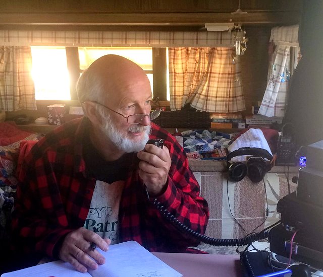
I’m involved with phone calls and texts while Clifford concentrates on his ham radio field day activity. He is using several modes, has made 30 contacts with low power in six states and two countries so far. I know he will be up late into the night.
Amateur Radio Field Day is underway for Clifford
Sunday June 24: Another lovely day on the mountain. Clifford continues with his field day activities until it ends at noon. I text ham radio friends who are doing their field day in tents on a rainy mountainside in western Montana. Man, we sure do have it nice here!
Last contacts for Field Day 2018
I play viola in the yurt away from the breeze and the flies, read, and write in my journal until Clifford wraps his field day. Later, we go for a hike to see if there are any camping spots that we missed in case we come again and find this spot taken.
Monday June 25:
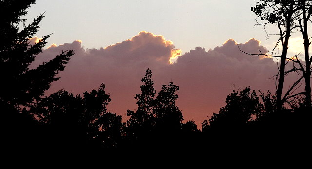
Catching the rising sun
Even though field day is officially over, we are going to stay on the mountainside. Clifford has received a portable high-quality microscope (which I brought up on the errand day), so his studies and research can continue right from the mountain. I take care of CI email and then begin the re-editing of Princes and Priests, Ang’s first book of the Novels of Shannon series. Later, Clifford and I go for a walk before dinner, and after dinner we read until time for bed.
Walking in the aspens near sunset
Tuesday June 26: I go for a long walk by myself this morning. This is really a beautiful area with the huge gnarly pines trees, aspens, scrub oak, among other vegetation.
Gnarly sub-species of ponderosa pine
Today is a day of editing for Ang, writing blogs, and editing photos. Viola, journal, and reading also find their way into my day. It is a study day for Clifford.
Study day for Clifford
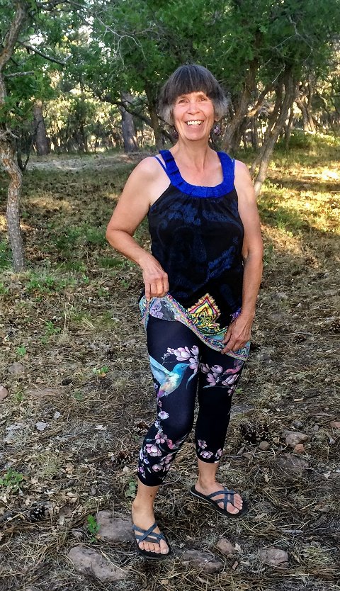
Wednesday June 27: I pick up more rocks and load them into the Suburban before making another trip down the mountain for errands and home chores. At the post office I have a package from Becka, including the cutest leggings and a summer top. It is so fun to get a package!
Pretty leggings and summer top from Becka
I drive back up the mountain with the setting sun in my eyes (again). After we unload the groceries, I make nachos for dinner and even after sunset it is warm to eat outside. Then we go for a moonlight stroll, Clifford in his house shoes and me in my Tevas. Back at camp we read until bedtime.
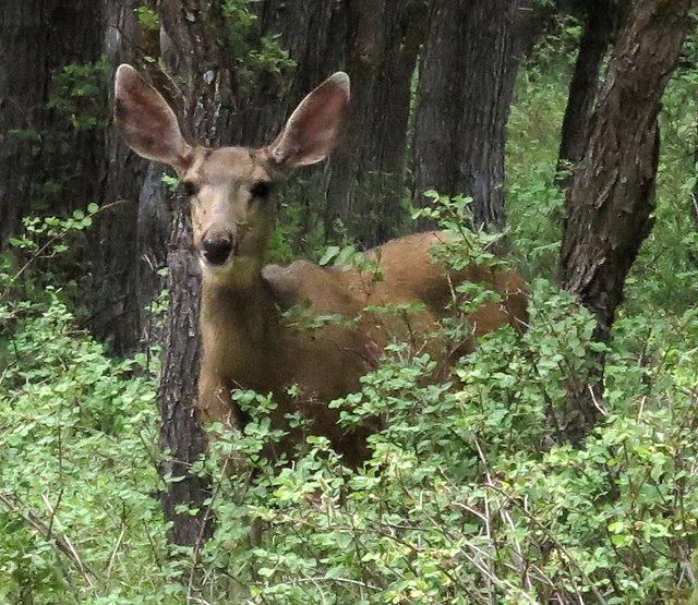
Thursday June 28: Sure could use some rain here – only 1% humidity this morning! I show Clifford the bear scat that I found just beyond the scrub oak grove by our campsite. The first night we were here, I smelled something musky, almost like skunk, but not quite. From talking with Ang, I think it is was a bear, but he/she has not bothered us at all.
A shy visitor
Meals, calls and text conversations with my kids, playing viola, editing, and blog writing for me; studying, reading, writing and ham radio for Clifford – good day on the Abajo Mountain!
Gnarly pine tree behind our campsite near sunset
Friday June 29: Another lovely day on the mountain with all the usual good activities.
Good mountain activities
We receive good news that my brother Rollie has sold his house, bought a big Class A motor home, and is now officially a full-time RV’er. Way to go, Rollie!
Saturday June 30: Our last full day here. It has been a great camp and we might have talked ourselves into staying longer, but our webmaster is coming tomorrow, and soon we will begin preparations for our summer journey to Montana!
Sunday May 27: It is a beautiful spring morning, so we decide to go up Abajo Mountain for an outing. I make a picnic lunch and thermoses of tea, and off we go. For the first time, since we also like to explore, we turn left on the Lloyd’s Lake Road just outside Monticello and head up Abajo a different direction from where we’ve been before.
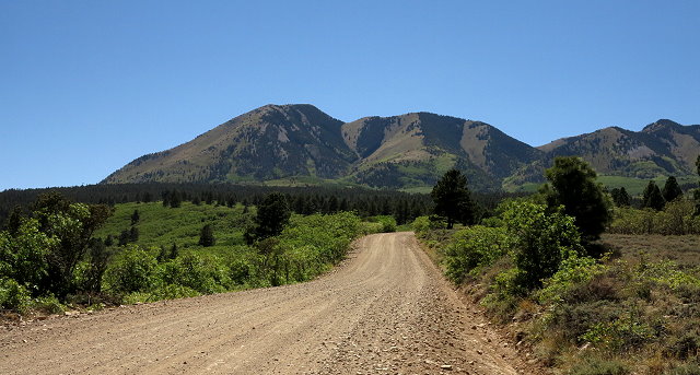
Abajo Mountain ahead
It’s a beautiful day for an outing with the blue sky and the variety of trees, aspens being one of my favorites.
Great blue sky
Aspens line the road at times
I have an ulterior motive: the neighbor has told me where I can gather rocks needed for the landscaping I’m doing in the back yard.
We go quite a ways up the mountain, not having yet seen the rock slide, and turn on a side road named Electronic Road. There is a tower of some sort here, and although it is not a great place to gather rocks or have a picnic, since we are here, I start picking up a few rocks. In less than ten minutes a 4-wheeler turns on the same road and it turns out it is a park ranger, probably wondering why we are so close to the tower. I tell him we are exploring and looking for a place to have a picnic and he recommends we go on up the road to the top where the main set of towers are – a great view, he says.
So we do that, but the further up we go, the more we wish we hadn’t. The road isn’t bad, but it is very narrow and no place to go if we meet someone coming down. Right before the last ascent to the towers themselves, there is a wide turnaround spot and we take advantage of that. The views are quite expansive.
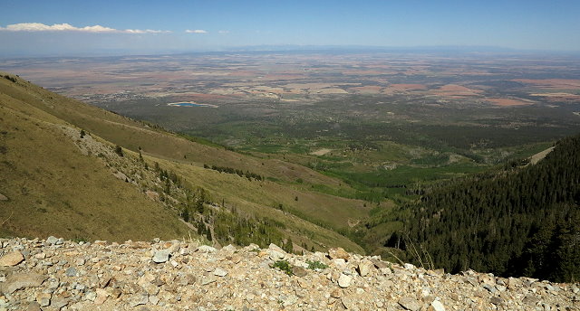
Expansive views from way up on Abajo Mountain. Monticello and Lloyd’s Lake can be seen left center
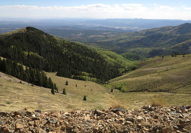
Looking the other direction from the turnaround
On the way back down, we are ever so grateful not to meet anyone, other than motorcyclists who squeeze by us. We stop at the rock slide we passed on the way up and gather rocks.
One of several rock slides
A ways further down, we turn off onto a side road to a camp spot we had also passed on the way up. We set up a little table and have our picnic, relaxing as we enjoy our late lunch.
View of where we have been, as seen from the picnic pullout
It was a good outing, but we are not likely to take the road beyond the rock slide next time. That was far enough for us!
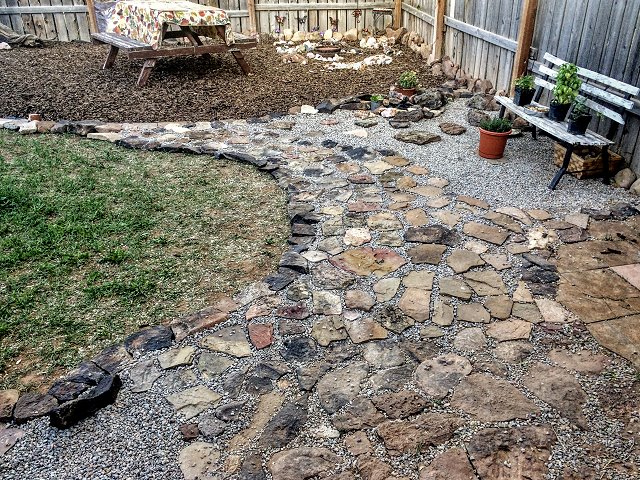
Landscaping moves forward with rocks from the mountain
Thursday May 10: We are leaving for Tucson today to participate in the StopGeoengineeringTucson Conference in Tucson, Arizona, an event being put on by activist Matt Landman. Clifford has been invited to speak, along with several environmental activists.
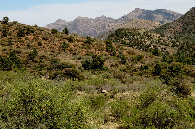
It is a hot dry windy drive from Monticello through the barren land of the Navajo Reservation in northeastern Atrizona. Sand/dust twisters are frequent and we are even hit by one that crosses the highway, shoving us over at least a foot or two.
Northern Arizona landscape
As we approach Snow Flake, Arizona, just north of Show Low where we will be spending the night, we see ponds, trees, and green fields. What a difference!
Green
We arrive in Show Low in the early evening, find our motel, then meet up with our webmaster, Kaylee, who will be joining us at the conference. While Clifford naps, Kaylee helps me make small changes to the CI website, as well as setting up a gallery on my photography website. Good to see him and to have such personalized web assistance!
We go out for a late dinner, visit awhile – lots to catch up on – and then bed way too late.
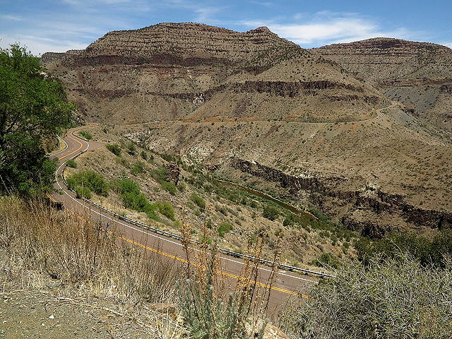
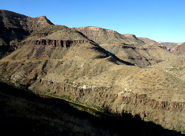
Friday May 11: After showers and making tea for the thermoses, we are on our way. It is even hotter today, still dry and windy, but at least the landscape is more interesting, especially as we go through the Salt River Canyon. I would have liked to stop for photos, but the pullouts are on the wrong side of the highway, and Clifford is eager to get to Tucson.
Winding highway through Salt River Canyon
Heading south after leaving Salt River Canyon
Arriving in Tucson, we find our air B&B. It is locked and we can’t get in, so we hang out in the little courtyard. Eventually, in a round-about way, we are given the combo to unlock the door. The place is funky in a grungy sort of way, but it was the only place available this weekend. So, we will make do, including me giving the kitchen a cleaning before it is suitable for our needs. We are joined by others who will also be participating in the event.
Saturday May 12: We leave our B&B early, without breakfast, so we can get spots in the parking garage at the event center. We had been told there would be a food court open, but unfortunately, this is not the case and finding food during the day takes a bit of a scrounging around. A Panda open nearby and a Starbucks are most helpful.
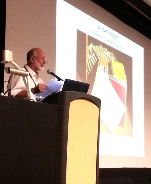
The conference goes well, as all the speakers are exceptional as they speak on their topics.
Clifford speaking at the StopGeoengineeringTucson
After the conference, we all help with cleaning up the auditorium. Back at our B&B, a group of folks gather in the small front room and interesting conversations ensue. Later we all walk to a street where night-life is active and we find a place where food is still being served. It is way too noisy for me (and Kaylee, also, I’m thinking), but everyone else seems to have a good time.
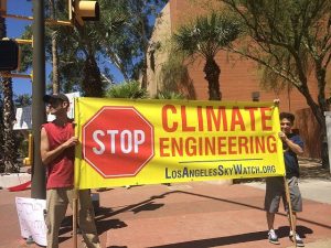
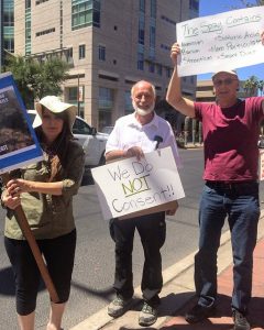
Sunday May 13: Mother’s Day. Many of those who attended the conference, either as speakers or audience, turn out for a protest against the environmental toxins that are being deliberately introduced into the atmosphere. It was interesting to see teenagers, young families with small children, middle-age folks, and the senior group all participating in this protest.
There are lots of us who are aware and care about what is being done to our Mother Earth and her delicate atmosphere.
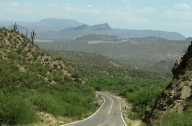
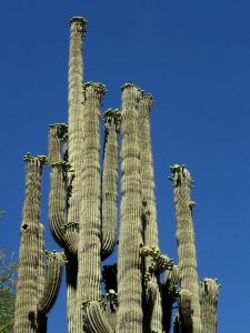
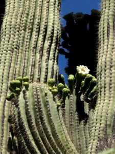
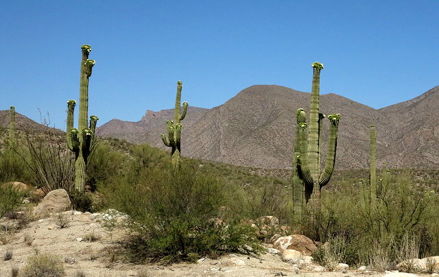
As the protest winds down, we say good-bye to our friends and begin the trip home. It is not as hot and windy today. I am excited to see saguaro in bloom for the first time, but it sure is hard to get photos as we drive. A brief stop at a possible camping area helps out.
Landscape north of Tucson
Leaving the saguaros behind
At Salt River Canyon, we stop at a couple pullouts, but the shadows are already too deep for good photos.
Salt River Canyon – the Salt River can be seen at the edge of the shadow
We also stop briefly at the Visitor’s Center at the bottom of the canyon.
View from the Visitor’s Center at Salt River Canyon
Salt River Canyon as we head up and northward
Beyond that, the landscape is quite barren and I knit more than watch the scenery.
Tonight we enjoy a nice room at Motel 8 in Holbrook, Arizona. The long drive through the hot dry desert, as well as lack of proper nutrition and sleep these past few days, has been exhausting. I am glad for the comfortable room and head to bed as soon as I can.
Monday May 14: After the continental breakfast, which was quite good, we hit the road – another 325 to Monticello, most of it through the deserts of northeastern Arizona.
Northeastern Arizona landscape
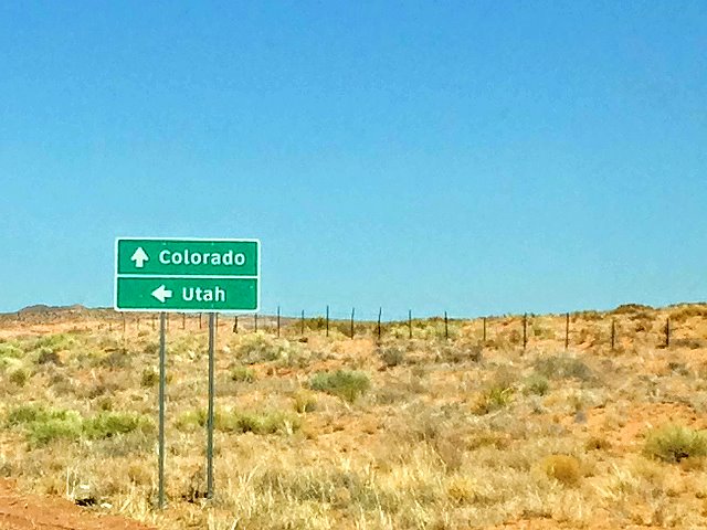
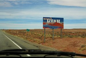
Junction of Arizona State Highway 160 and highway 191, which takes us to Utah.
Utah, here we come
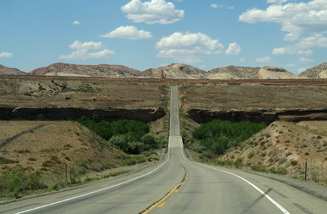
We take a break from driving when we cross the San Juan River in southern Utah, exploring the campground there.The river is a joyful sight to me!
San Juan River
Although we are now in Utah, we still have a ways to go.
Utah landscape
We arrive in Monticello in late afternoon. It was an important and jam-packed few days, but I’m really glad to be back home.
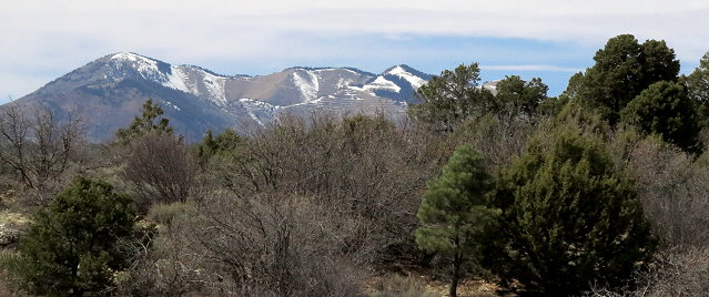
Clifford and I returned to Monticello the very end of March after our winter journey to Arizona.
Abajo Mountain in SE Utah with snow into the early spring
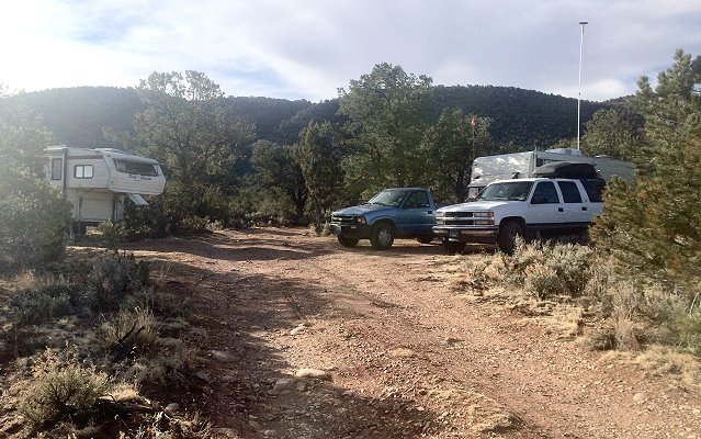
April was a time to catch up with business and time in the lab for Clifford. However, we did have one outing, mostly due to the fact that our Suburban needed to go back to the dealer in Moab to see if they could fix the ongoing problem we’ve had with it.
Castle Rock seen from Utah State Highway 191 between Monticello and Moab; La Sal Mountains in the background
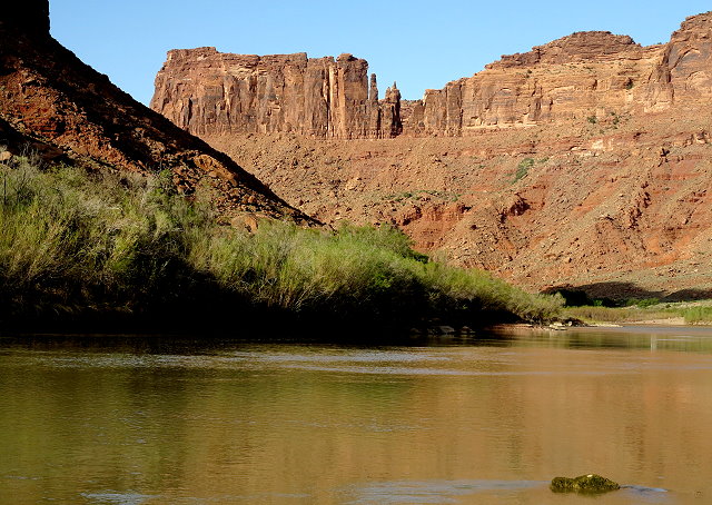
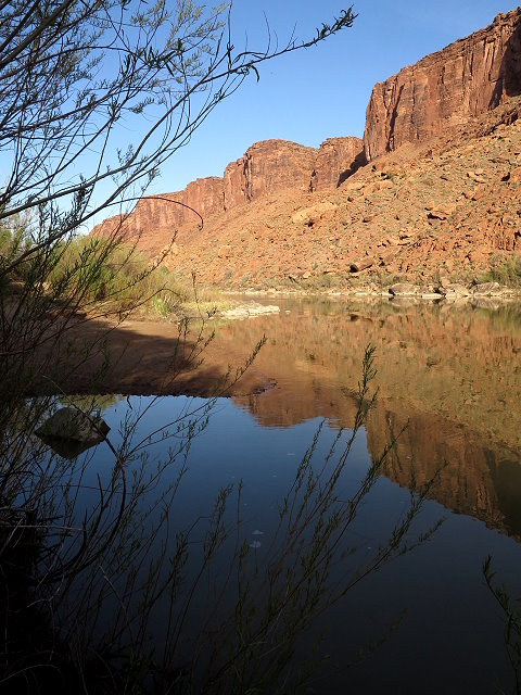
We found a place to camp along the Colorado River – no small feat! – and then delivered the Suburban to the Chevy dealer.
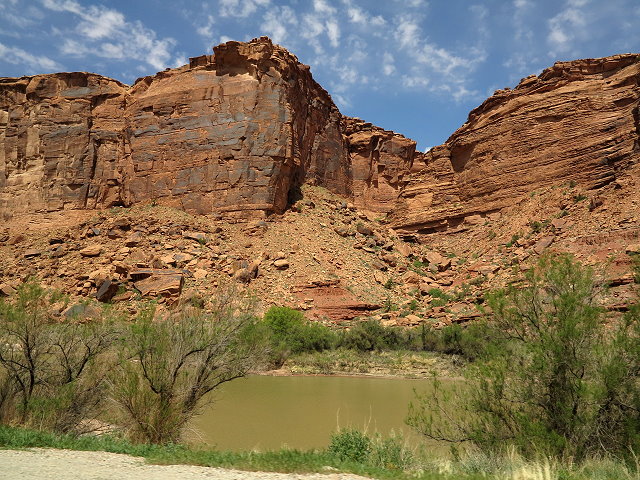
The Colorado River along Highway 28 north of Moab is the boundary of Arches National Park
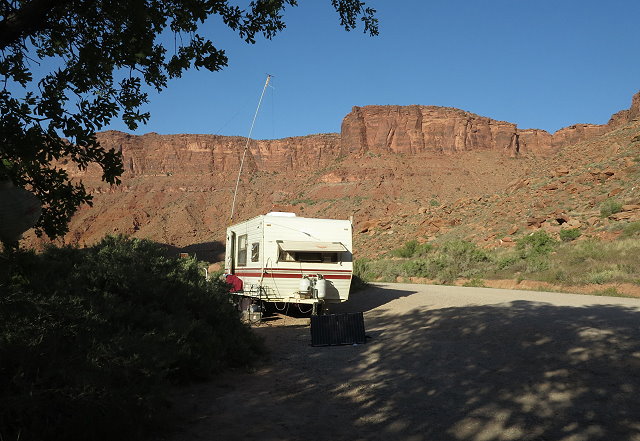
Terry is set up in the Drinks Canyon Campground
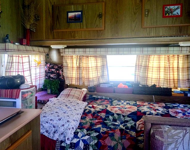
Small, but cozy and comfortable dwelling
We were given a ride back to our campsite and for the next week we waited without word and without transportation for our Suburban to be repaired.
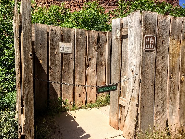
The “restroom” at Drinks Canyon is rather rustic and leaves a bit to be desired.
In the end we, we got word to them that we couldn’t stay longer: Clifford had suffered a serious health issue and we were also trying to prepare for a trip to Tucson where Clifford would be speaking at a conference.
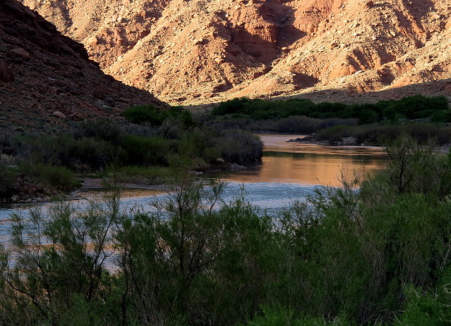
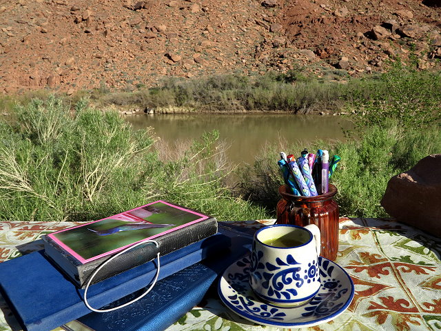
In spite of the uncomfortable side of the situation, it was also a time of enjoying being camped with a view of the river
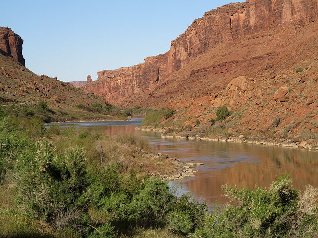
Colorado River – view upstream from our campsite
Colorado River – view downstream from our campsite
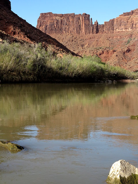
Reflections on the river
Reflections on the river
Colorado River – view at sunset
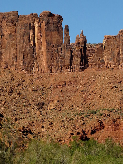
and the great red mesas,
View of the mesa somewhat to the north of our campsite
View of the mesa right across the highway from our campsite on a sunny day.
View of the mesa on a partly cloudy day
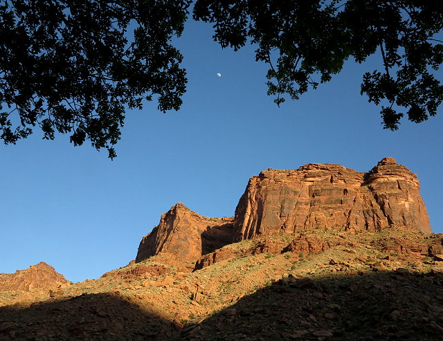
and a young oak grove that provided shade so we could sit outside to do some of our work.
I sit at the picnic table to write in my journal with a morning cup of coffee
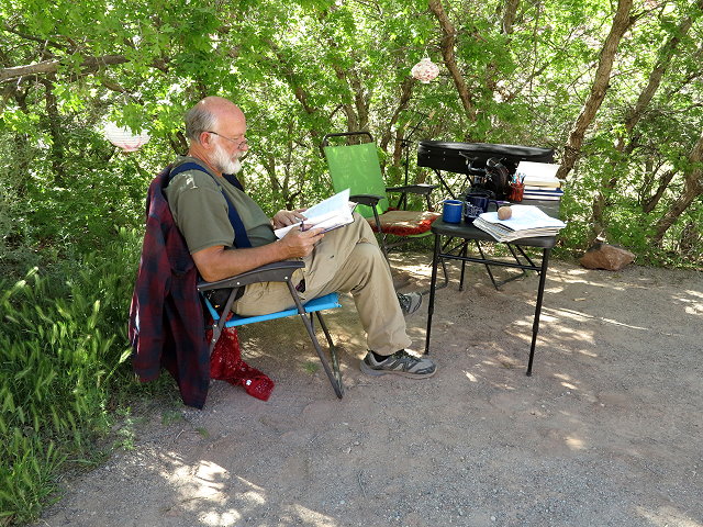
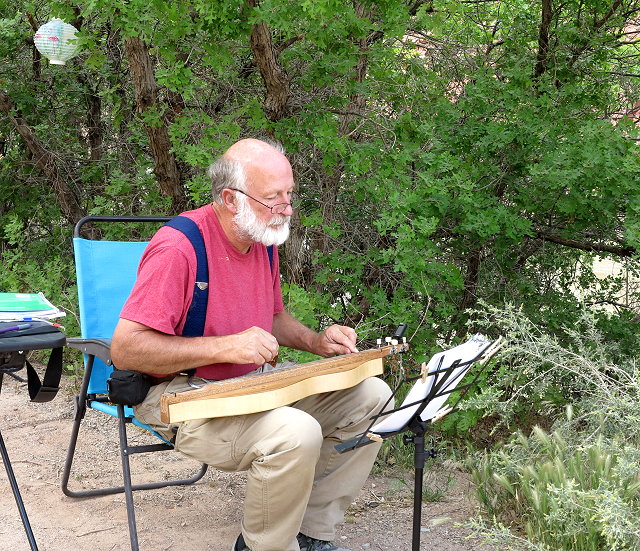
Clifford enjoys of the shade of the oak grove as he studies…
and as he plays his dulcimer
Although the Suburban was not repaired, the scenic surroundings were much appreciated as we hung out by the river waiting……..
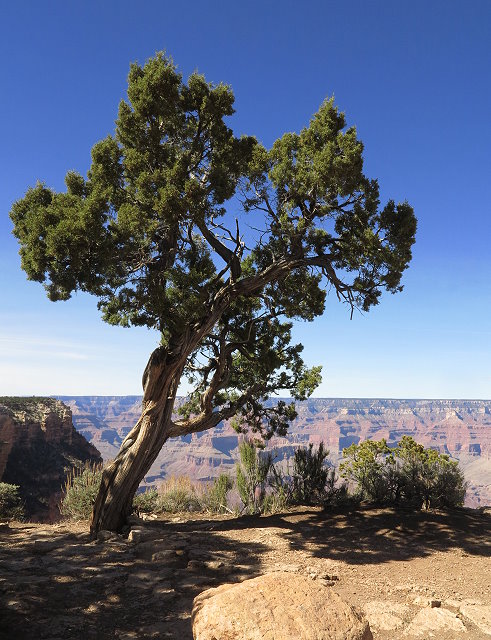
Thursday March 29: This morning, we – Clifford, Rollie, Ninja, and I – are going to the Grand Canyon National Park, about 12 miles to the west of our boondocking spot on FR 307 off Arizona State Highway 64. I make tea for the thermoses and a picnic lunch, and off we go.
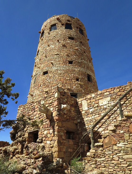
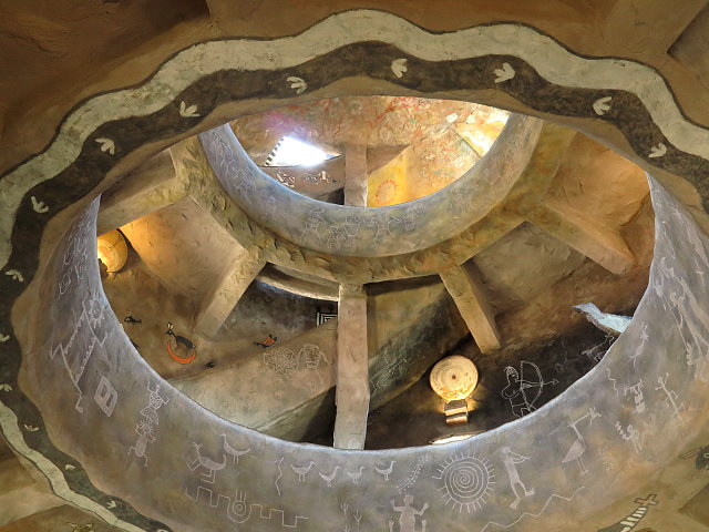
Our first stop is the Visitors Center at Desert View, located at the very east end of the park. We tour the Watchtower, an amazing and beautiful architectural work of art, inside and out. The architect and builder, Mary Colter, was a woman of great vision.
The Watchtower at Desert View
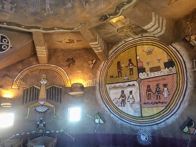
Panels of Native American art adorn the walls on every floor of the Watchtower
The staircase spirals upward along the outer wall, leaving an opening to the top
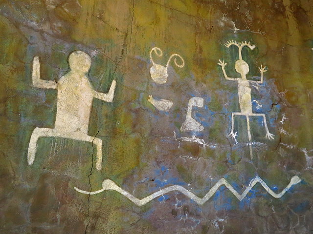
Replicas of petroglyphs on the walls of the Watchtower
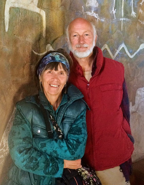
Carol and Clifford at the Watchtower
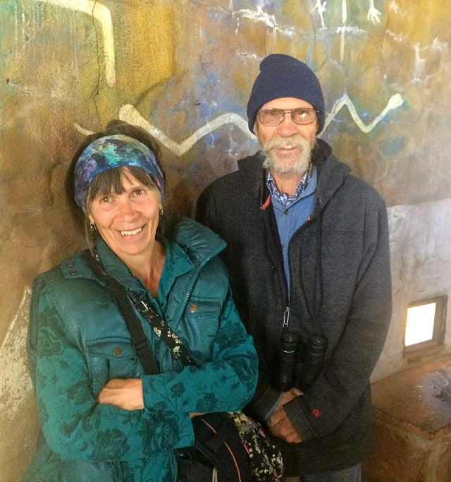
Carol and brother Rollie at the Watchtower
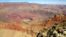
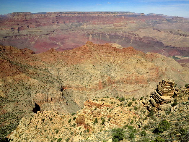
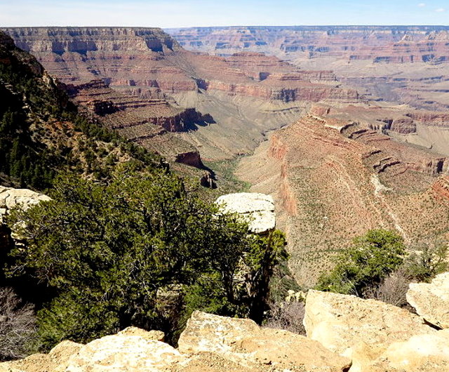
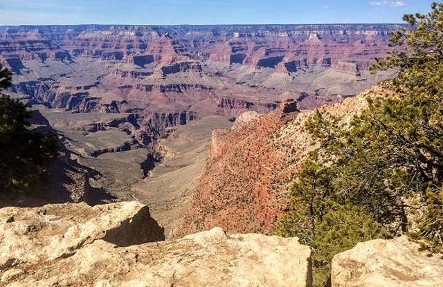
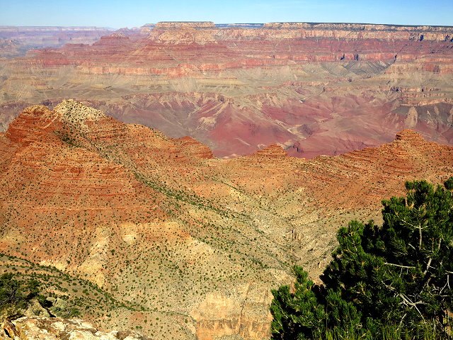
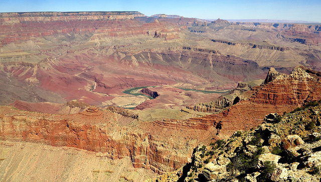
I take photos of the canyon from Desert View. The lighting is not the best, but it is what it is.
Canyon views from Desert View
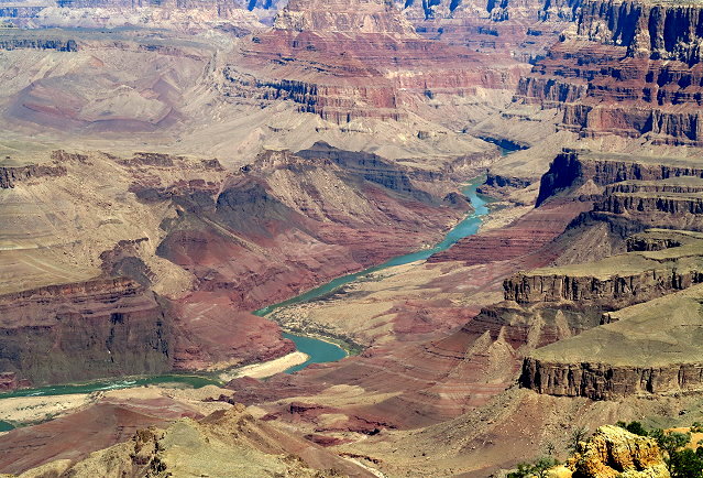
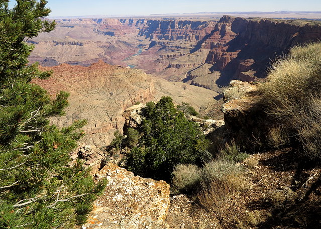
Far below, the Colorado River carves its way through the canyon
Every window of the Watchtower is placed so as to frame a geological feature, including this formation
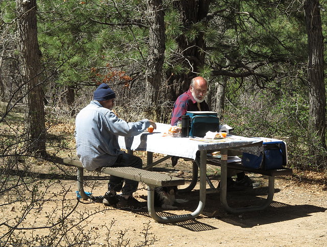
After we leave Desert View for more sight-seeing, we stop at a picnic pull-out and enjoy our picnic lunch.
Picnic at the Grand Canyon
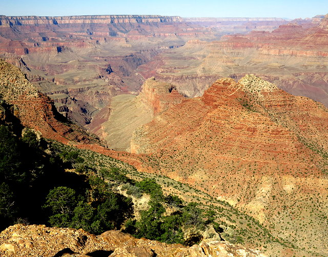
Then we drive on to Grand View Point, hoping to find the Rim Trail so Ninja can get out and walk with us, but no such luck, so he stays in the car.
A little slice of the Grand View
Next is Yaki Point and we find the Rim Trail. We have an enjoyable hike along the rim before we head back to camp.
Life on the trail near Yaki Poin
Rim Trail near Yaki Point
Along the way back, we stop to explore other dispersed camping areas on highway 64, but we like the spot where we are the best.
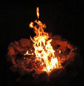
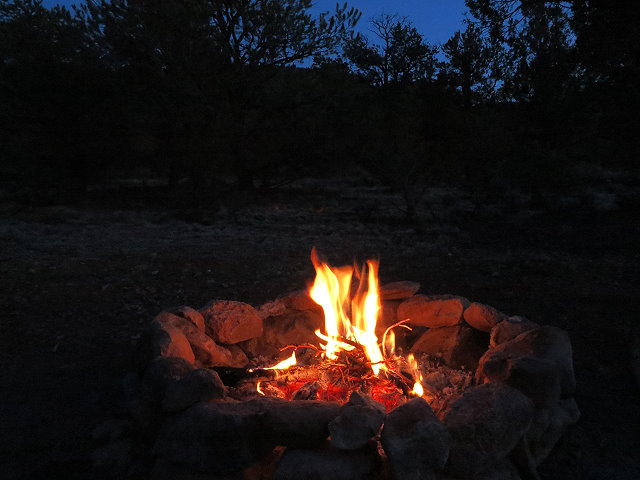
Back at camp, we enjoy a campfire and play music until it gets too chilly.
Then I make dinner for all of us and play a game of cribbage with Rollie. Later Clifford and I have a discussion about ozone and ether, topics of interest in connection with his research. And bed late.
Friday March 30: We are going to the Grand Canyon again this morning, leaving earlier and planning to be back in time for lunch here. No need to make a picnic, and since Rollie is going to buy me a latte at the Desert View Gift Shop&Store, no need for thermoses, either.
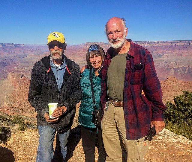
Rollie, Carol, and Clifford at the Grand Canyon
At Desert View, as we enjoy our hot beverages, we take more photos and chat with a couple from Pennsylvania.
Enjoying the view from Desert View while we chat with other visitors to the Grand Canyon
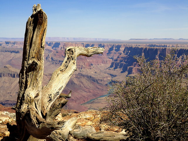
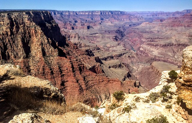
Today we go to Navajo Point, Lipan Point, and visit the Tusayan Museum.
Navajo Point
Lipan Point
We take lots of photos at every point and then return to camp in time for peanut butter and jam sandwiches. Easy and tasty!
Rollie and I explore further up the road from where we are camped and find a much larger campsite, one that could work for us in the future, should we come this way again.
We have breakfast burritos for dinner by the campfire, a pleasant and relaxing end to our couple of days here.
Dinner at the campfire
Saturday March 31: We start packing as soon as we are up, leaving FR 307 once we are all ready. It has been a good spot, but it really is time for us to get back to Monticello. Rollie is going to caravan with us that far, which will give him a day to relax and get his laundry caught up before he heads on north to Montana.
The caravan leaves FR 307
We backtrack to highway 89, then travel north until we reach the junction with highway 160, which runs east across the northern tier of Arizona.
Badlands of northern Arizona
There are some crazy drivers here, passing when it is not safe to do so. There is a roll-over near Kayenta… not surprisng, but still sad for those involved. There is a long delay before we can go on.
Arriving at the junction to highway 191, we turn north and soon we are in Utah and back to our home base, no longer nomads for the time-being.
The Abajo Mountains come into view
It was a lot of miles, with many good camping spots and beautiful places to see, photograph, and hike. Plans are already underway for a trip to Montana in this summer…..
Wednesday March 28: 31 degrees this morning, a bit on the chilly side at our campsite on forest road 525 outside Sedona, Arizona.
Today is moving day; we will be heading north toward southeast Utah. I make tea for the thermoses; Clifford is soon up and we begin packing. Once we are ready to go, we see that our tail lights are not working. It is a blown fuse and replacing the fuse doesn’t help. Rollie helps figure out what is causing the short, and we are soon on our way with Rollie right behind us.
Clifford and Rollie fix the electrical problem
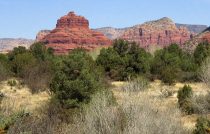
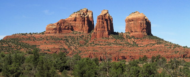
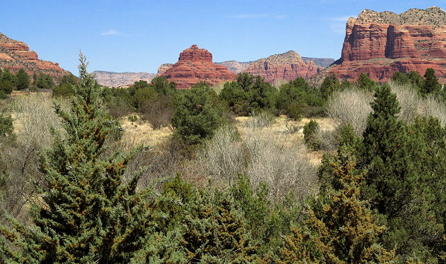
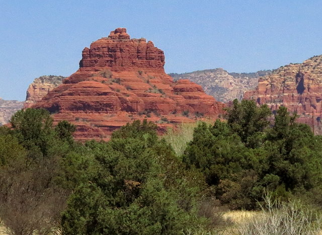
At Sedona we turn southeast at the junction to Arizona State Highway 179 and take this scenic route to the Visitors’ Center/Ranger Station where there are great views of Bell Rock (except for the jet trails which are really not good for photos or our health).
Scenic route – Arizona State Highway 179
Bell Rock as seen from the Visitors’ Center on state highway 179
Bell Rock detail
We watch a documentary of this red rock desert area, and then we are on our way.
The landscape changes dramatically once we are heading north on I-17, leaving red-rock country behind. We are headed to Cameron, north of Flagstaff, Arizona, for an overnight stay at a quiet truck stop (yes, this one was quiet the last time we were there), but Clifford sees a sign that indicates that the Grand Canyon is only about 65 miles away, so there is a quick change of plans.
We take the junction to highway 64, which leads to the Grand Canyon from the east. There are a few miles of forest service land between the Navajo reservation and the park boundary, and there we find dispersed camping on forest road 307.
Precursor canyon along highway 64.
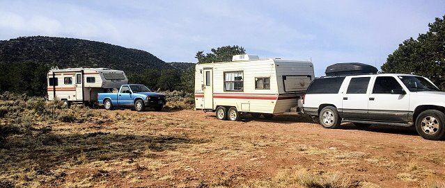
We get set up on a spur road, a pretty spot with junipers and sage, and a small mountain behind us.
Setting up camp on a spur road off FR 307
We pick up trash and rebuild the fire ring before I make nachos for dinner for all of us. Clifford has a call with his brothers, so I go over to Rollie’s camper for a game of cribbage. Later, back our camper, dishes are done, but I’m too sleepy to write in the journal. Off to bed, happy that we found this nice spot and that we have the Grand Canyon to look forward to.
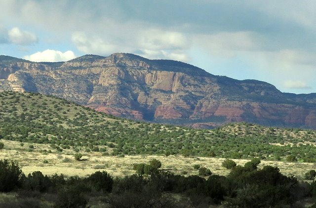
Tuesday March 27: The sky looks better today; it would have been a good day to go sight-seeing and taking photos of the red rocks around Sedona, Arizona. Oh well, hard to know.
I visit Rollie and we look at maps, as Clifford has mentioned going to Jerome while we are here. After breakfast, Rollie and I play music outside in the sunshine; sure nice to be able to do that. The neighbor in the airstream comes over with his guitar and joins us, which is great fun. Afterward, he shows us his airstream – big enough for his wife, four daughters, a big dog, and himself full-time. An airstream sure would be a nice way to go, so well designed to utilize space.
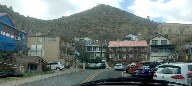
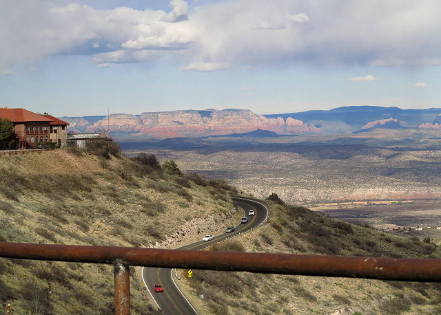
Then we make a trip to Jerome, Arizona, once a mining town on the side of the mountain, now a tourist place.
Main street of Jerome, Arizona, once a mining town, now a busy tourist town.
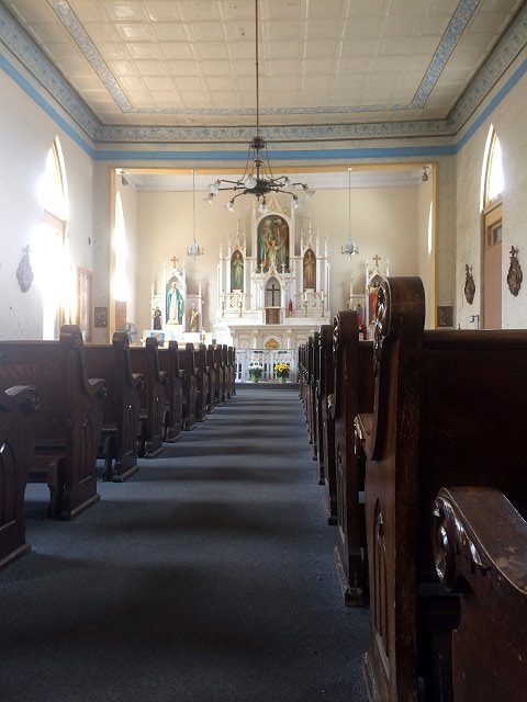
It was hard to find a place to park, but once we did, there was lots to see and do: we looked inside the old Catholic church,
The old Catholic Church in Jerome, Arizona
went through a museum (guess it is not the main one), popped into a few other shops, and had a tasty lunch at Mile High Cafe. Fun outing.
View from Jerome, Arizona
Heading back to FR 525
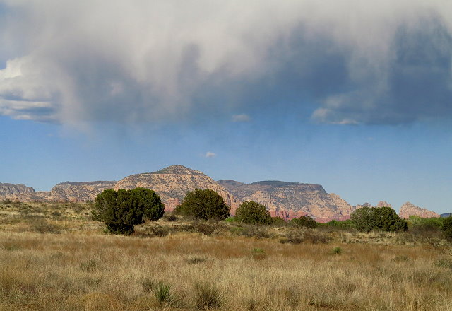
Almost looks like rain
Back at camp, as it almost looks like rain, we set up the screen house again and anchor it down so Rollie and I can do music outside even with a breeze and a sprinkle. Another neighbor comes over to take photos of us as we play, and a perky college girl traveling in her car during spring break comes over to chat after she gets her tent set up. Sometimes a village can be quite fun.
I don’t fix dinner tonight, since we had a big lunch in Jerome, but still play a game of cribbage with Rollie before heading into the evening routine and to bed.