Friday November 11th, after a long layover in Salt Lake City in the wee hours of the morning, it is with great relief that I board an uncrowded bus that takes me to Moab, where Clifford is waiting. We get propane and a few groceries, before going to the Moab Brewery for a good lunch. Then on out to Horsethief campground just outside Canyonlands NP where Clifford camped while I was gone.
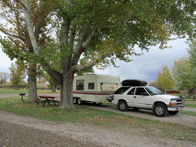
Clifford’s campsite at Horsethief Campground
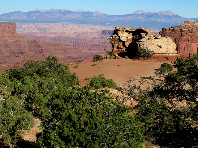
It is a big campground with roomy sites and views of the mesas; it would be nice to stay here for awhile, but the 14-day limit has been reached. I unpack my bags as Clifford and I catch up the news. I am exhausted, feeling caught between two worlds.
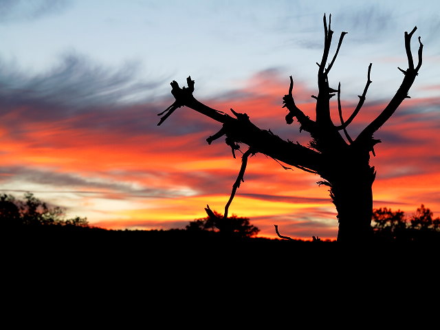
Sunset at Horsethief Campground
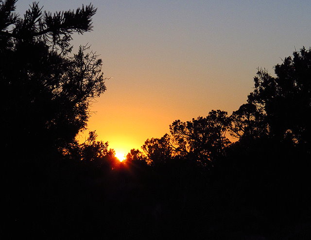
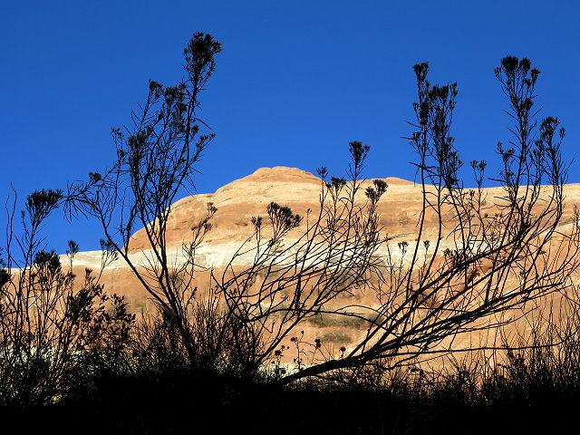
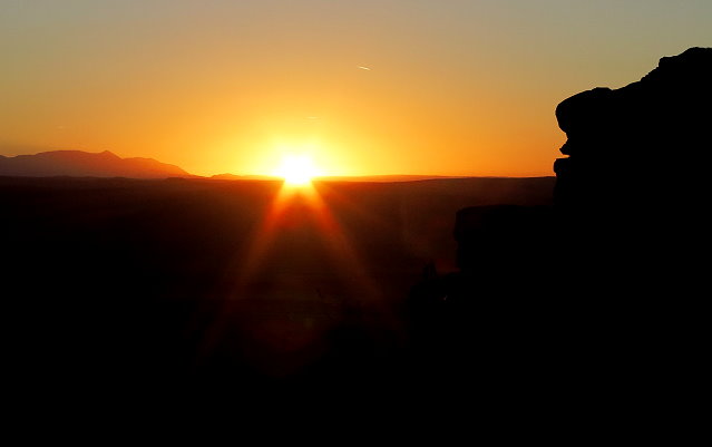
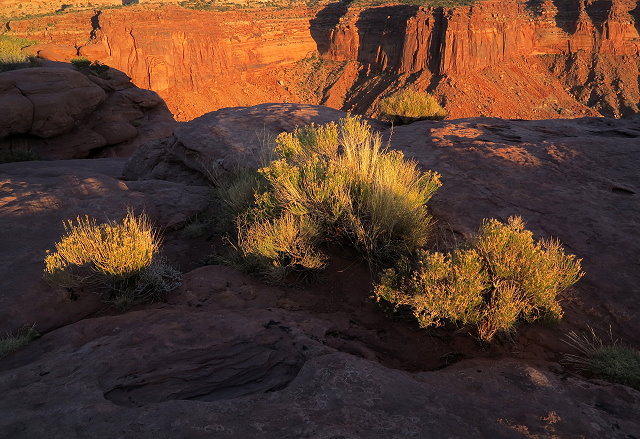
Saturday November 12th –Since I am up before Clifford, I go for a walk on the trail near our campsite, getting photos of the sunrise. I like it here; too bad we have to move.
Sunrise at Horsethief Campground
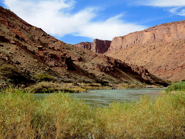
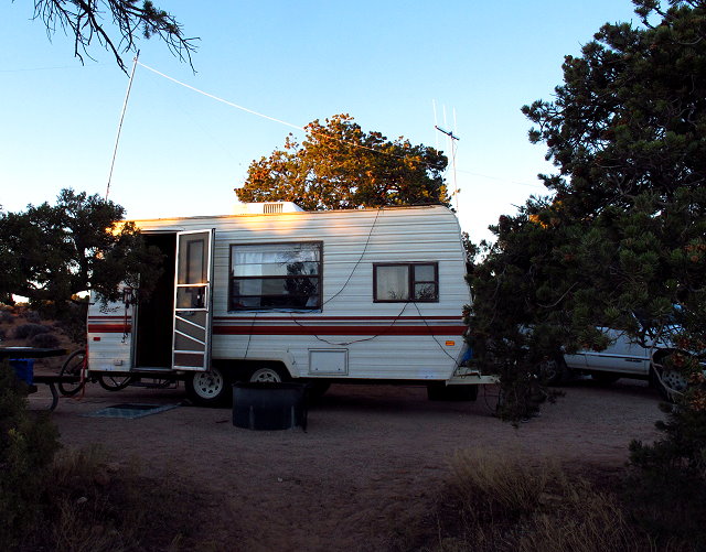
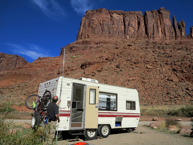
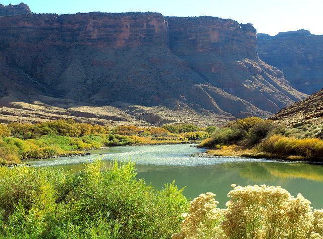
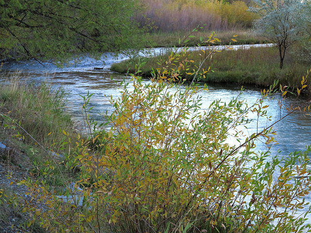
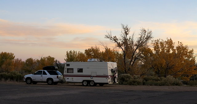
As soon as Clifford is up, we pack up and head toward Moab and east on Highway 128. We are fortunate to find an available site at the Big Bend Campground along the Colorado River, about six miles out from Moab.
Colorado River upstream from our campsite at Big Bend CampgroundGetting set up. Notice Clifford putting up his ham radio antenna.Colorado River downstream from near our campsite
After we get set up, we realize that we left the sensor for the weather station at the Horsethief campground, so we have to drive all the way back out there to get it.
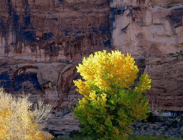
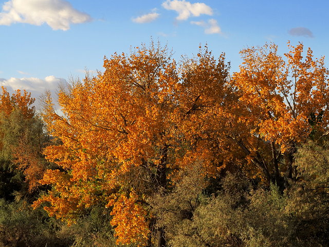
Autumn colors along the road back to Horsethief CampgroundAn interesting formation along the road to Horsethief CampgroundCanyonland vista
Returning to our new campsite, we take naps, only I can’t sleep, the words of Dave van Ronk’s song “Motherless Children” going through my head. I get up and write a short blog about the void in my life created by Mom’s passing. Dinner is late; I am too tired to do dishes tonight, so leave them for Clifford and go to bed.
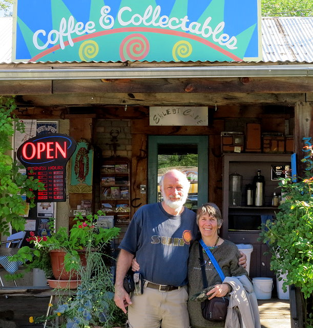
October 26th is a day with our friends, starting with breakfast at a cute funky place in Moab. Of course I took photos of them, but they have asked photos to not be posted.
Breakfast in Moab
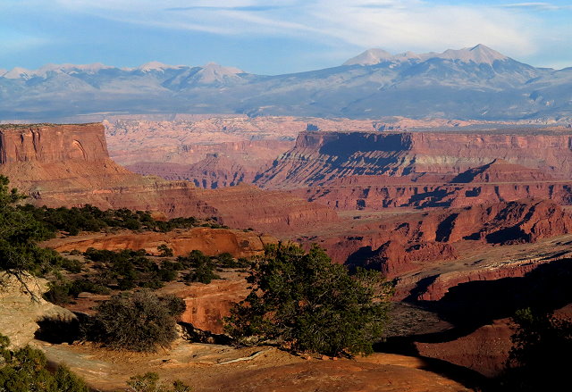
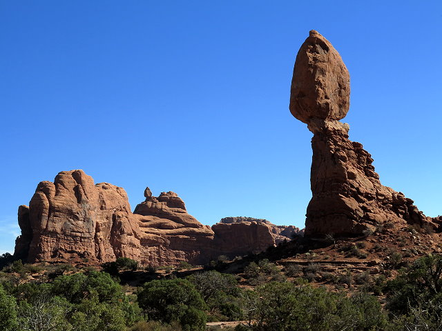
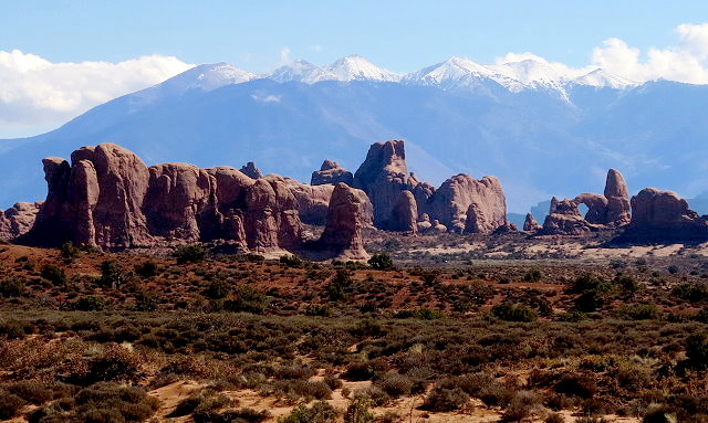
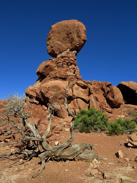
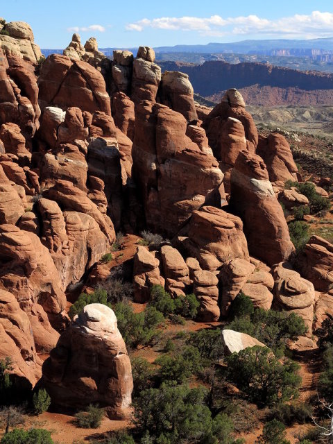
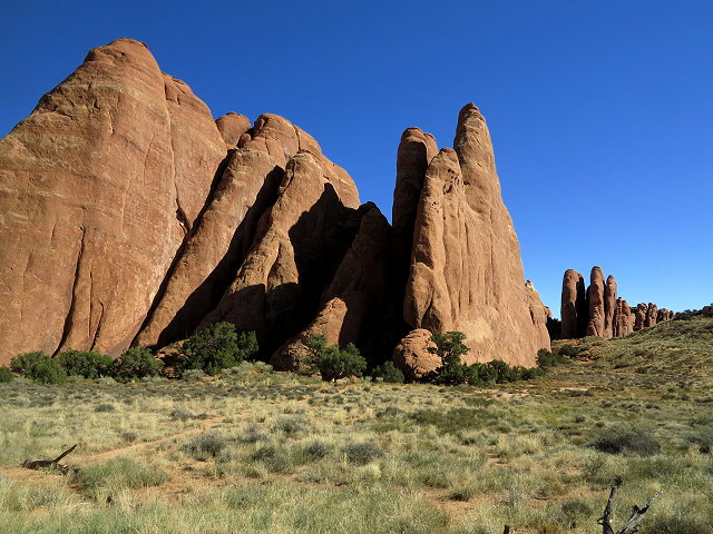
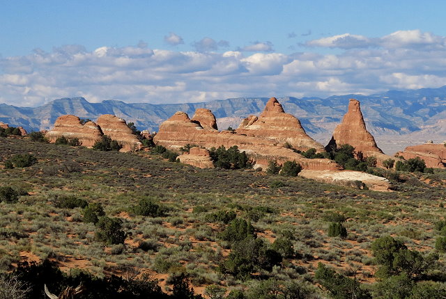
Then we head up to Arches National Park. We make numerous stops for photos, the most interesting being the Sand Dune Arch and the longest hike being the hike to Landscape Arch. Our first stop is Balanced Rock; from the Balanced Rock Trail, one can see formations in the distance, including Turret Arch
First stop is Balanced Rock
Turret Arch seen from the Balanced Rock trail
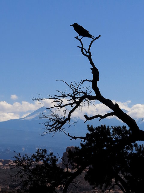
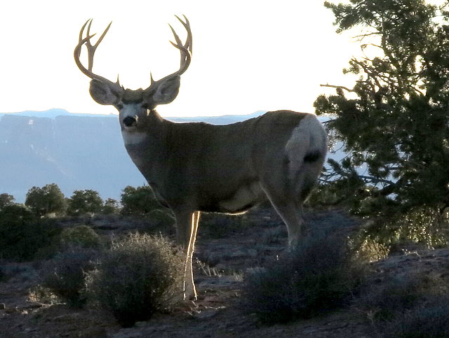
A local resident of the area surveys his domain
Another view of Balanced Rock
Next stop is the Fiery Furnace Formation named for the warm glow of the rocks in the late afternoons. We are here too early in the day to witness the “fire.”
Fiery Furnace Formation
Fiery Furnace close-up
View across the basin seen from the Fiery Furnace Overlook
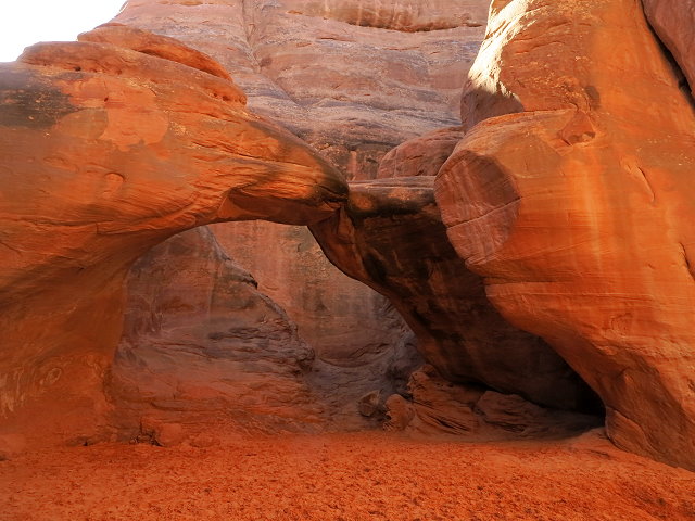
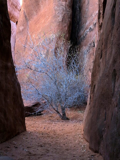
The Sand Dune Arch is most interesting to me, being hidden inside this formation. For this arch, the overhead sun brings the most color to the formations within the slot canyon.
Approaching the Sand Dune Arch
A tree growing in the slot canyon leading to the arch
The Sand Dune Arch rich with color at mid-day
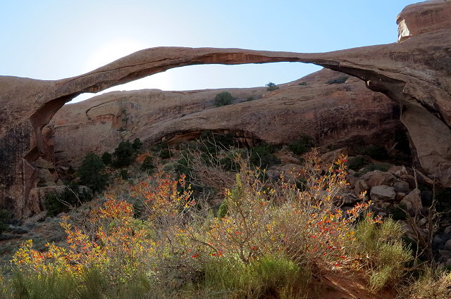
Our last stop of the day in Arches National Park is a hike to Landscape Arch.
Formations on the trail to Landscape Arch
Formations of the trail to Landscape Arch
Arrival at Landscape Arch
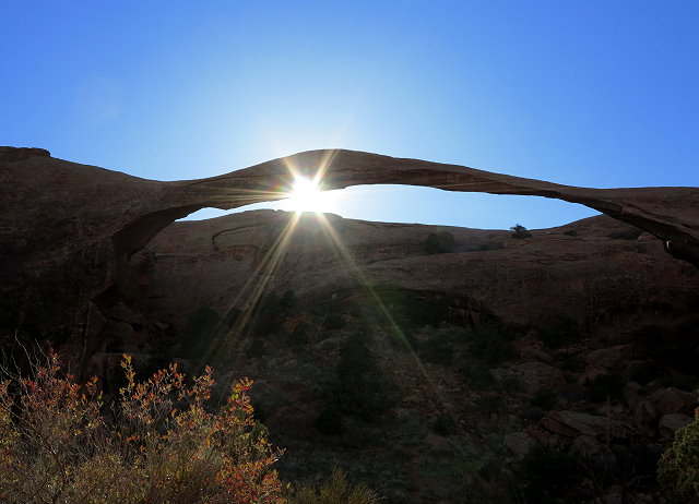
Landscape Arch moments before sunset
After the hike back to the trailhead, we all go Moab to browse in a bookstore, followed by dinner at a nice restaurant. We check our phones while we are in town, as there is cell reception here, but not at the campground.
Texts from my siblings indicate that Mom is stable and their talk with her doctor includes looking into rehab for the next 20 days. I have called the hospital several times, but each time Mom has been asleep or otherwise occupied, so I have not been able to talk to her. Although the indication is that there is not an immediate need to go to Missoula, I continue to look into getting a bus ticket.
As soon as we arrive back at our campsite, I head to bed. Its been a long day for me.
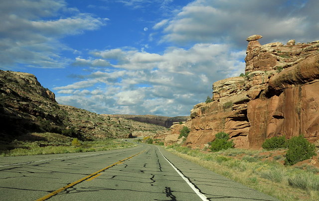
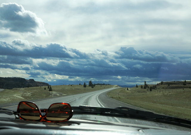
Sunday October 23rd, I read “Dances With Wolves” with my morning tea instead of writing in my journal – not sure that is legal! After breakfast we go to Moab to run errands and have a picnic sitting on big rocks under the trees at Lion’s Park.
Roadside view driving to Moab
On the way back to our campground, we check out the BLM campgrounds along the way: Lone Mesa is a bit too far off the highway on a washboard road; Horsethief is a future possibility. Too late to play cello by time we get back to camp and I’m feeling like I might be coming down with whatever Clifford had, so have a cup of tea and early to bed.
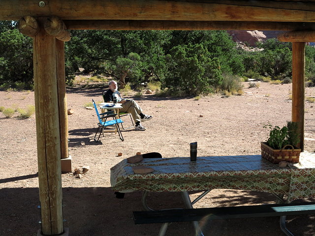
Monday October 24th, I finish reading “Dances With Wolves.” I don’t feel great today, but we go for a picnic at Upheaval Dome anyway. We find a picnic table with a nice view, but the wind has come up and probably not the best thing for me to be outdoors today. I am not up for the hike uphill to see the dome itself, so will have to save that for another trip.
Drive to Upheaval Dome
Back at camp, I rest, while Clifford plays with his ham radio. After dinner, Clifford does the dishes so I can go to bed. Heavy rain in the night.
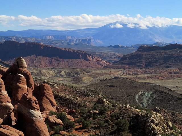
Tuesday October 25th, we just have vege juice for breakfast, as we need to pack up and head on down the road to nearby Dead Horse State Park, where we are meeting friends from Colorado.
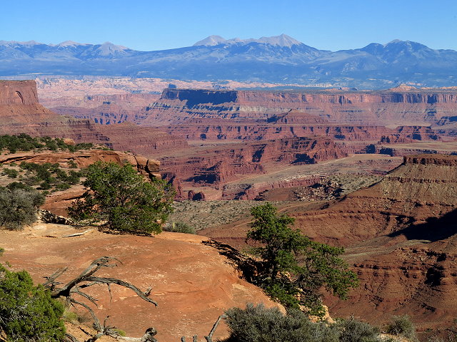
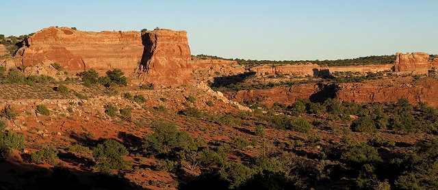
Crossing the mesa from Canyonlands NP to Dead Horse State Park
View of the canyon from Dead Horse State Park
One of my sisters calls; Mom is in the hospital again, and it could be more serious this time. I start looking into bus fares in case I need to head back to Montana; automated systems are not helpful – please give me a human being!
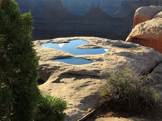
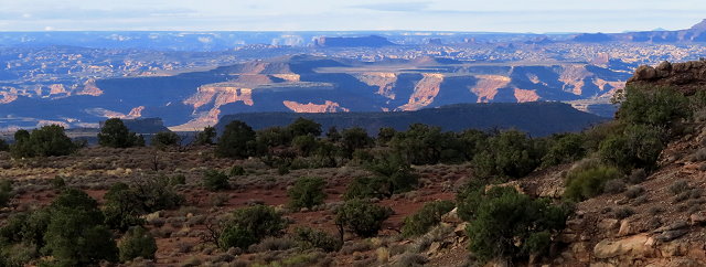
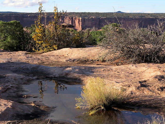
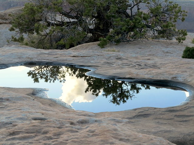
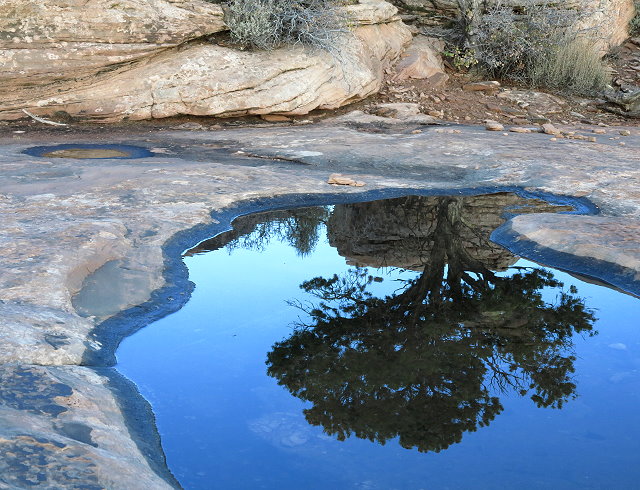
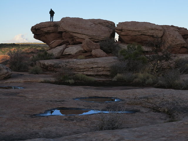
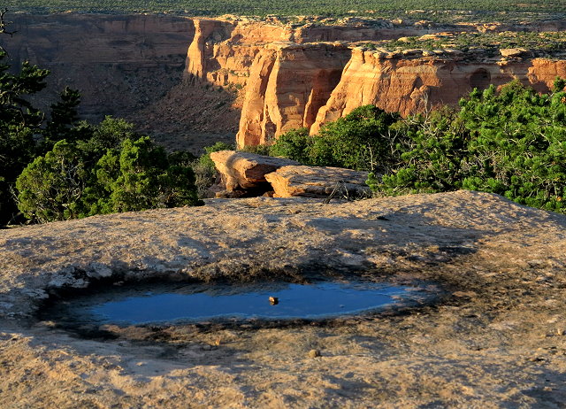
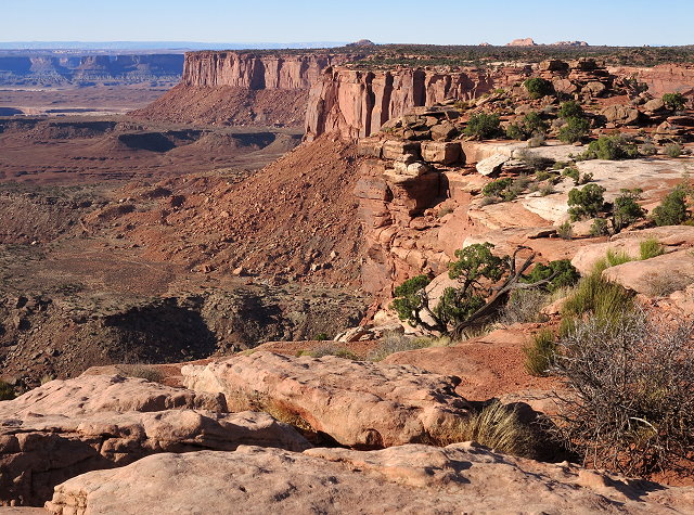
Clifford and I go for a hike with our friends along the West Rim Trail out to the Rim Overlook. Because of the rain last night, the depressions in the rocks are filled with rain water, which provides interesting photo opportunities.
Rock puddles and a mesa on the West Rim Trail
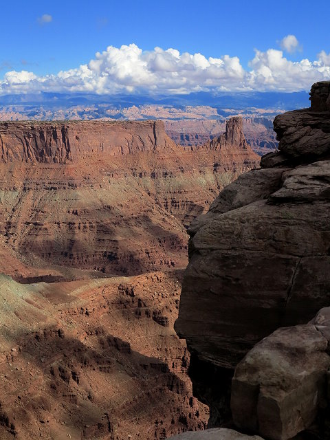
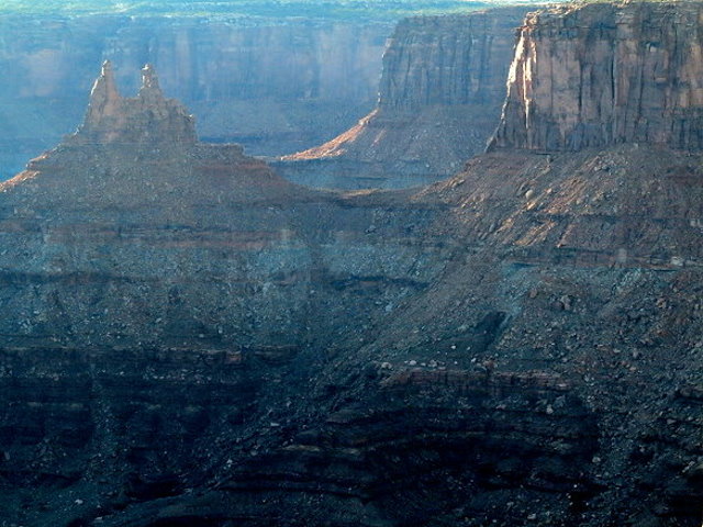
At Rim Overlook with the canyons in shadow
Rock puddles and junipers at Rim Overlook
Even though the canyon is in shadow, the views are spectacular.
Spectacular Views
Our friend finds a vantage point for canyon gazing
Shadows in the canyon
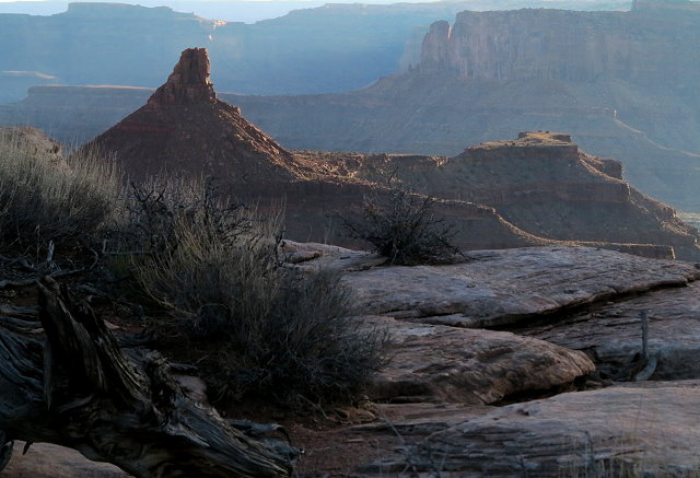
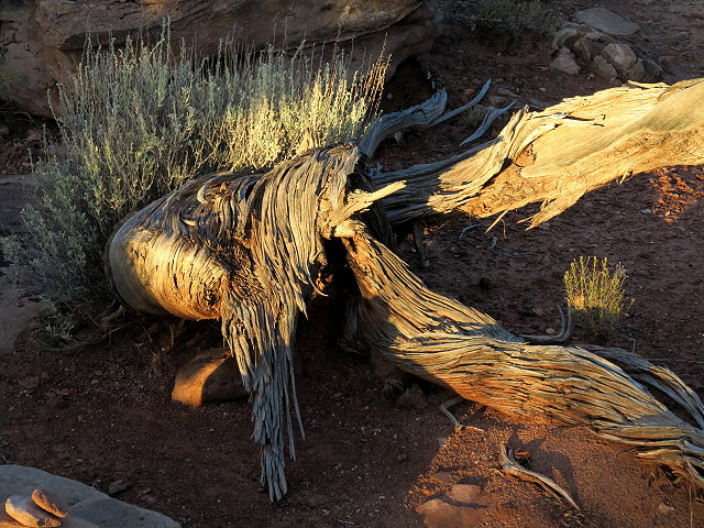
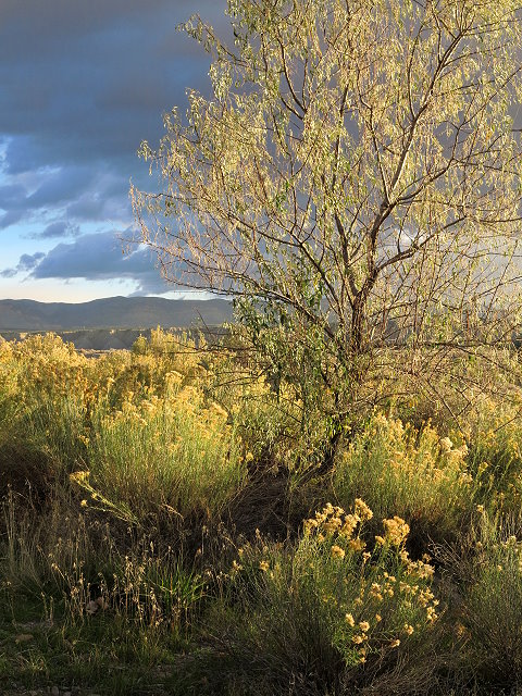
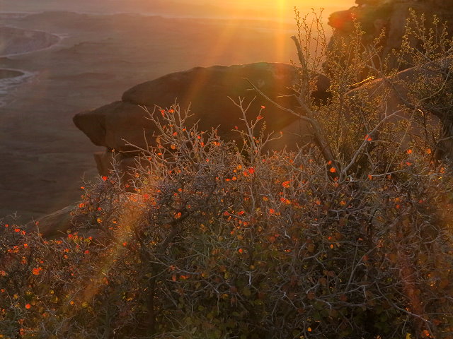
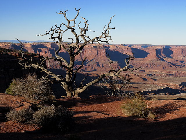
As we walk back to the campground, the last light of the setting sun bring warmth of color to the westward-facing mesas and our immediate surroundings.
Last rays bring warm color to the mesa
Immediate surroundings brightened by the last light of the sun
Though I am surrounded by the scenic beauty of the area and the company of our friends, I am preoccupied with trying to figure out bus schedules and decisions about when (not if) to head to Montana. The word from my siblings is that Mom is stable and plans are being made for rehab to see if she will be able to return home or not. Maybe I don’t need to rush the bus decision yet, but I am uneasy as the day ends.
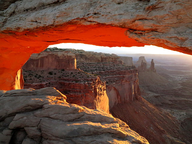
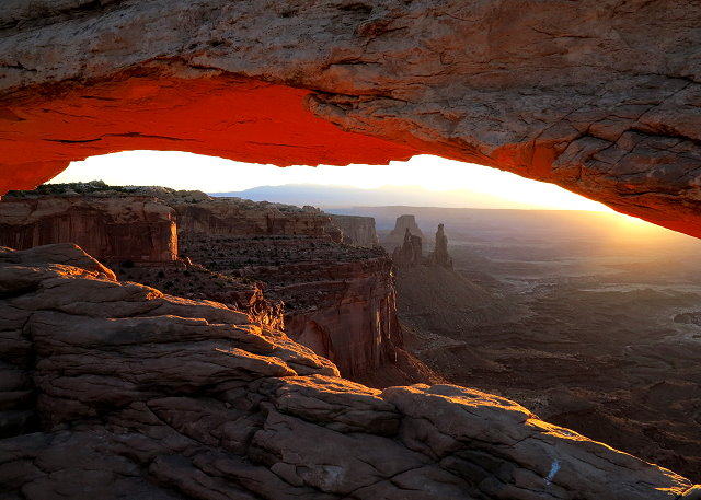
Thursday, October 20th, I get up early and head out in the pre-dawn to Mesa Arch, as I want to get there in time for sunrise photos. By time I get to the parking lot, the sky is already becoming light and the parking lot is nearly full. Guess I should have come earlier! I hike to the arch and am dismayed to see the arch opening lined with photographers, shoulder to shoulder, with their fancy cameras and huge lenses on hefty tripods. There is literally no place for me to stand to get a shot of the arch that will soon reflect the glow of the rising sun. Finally some guy kneels down behind his tripod and I can shoot over his shoulder, but I still get the camera of the photographer next to us in my photo. After the sunrise glow on the underside of the arch comes and goes, several photographers move off. An interesting thing happens: after a short period of no glow, the rocks below the arch begin to reflect the sunlight up to the underside of the arch and the lovely famous glow returns.
Mesa Arch at sunrise
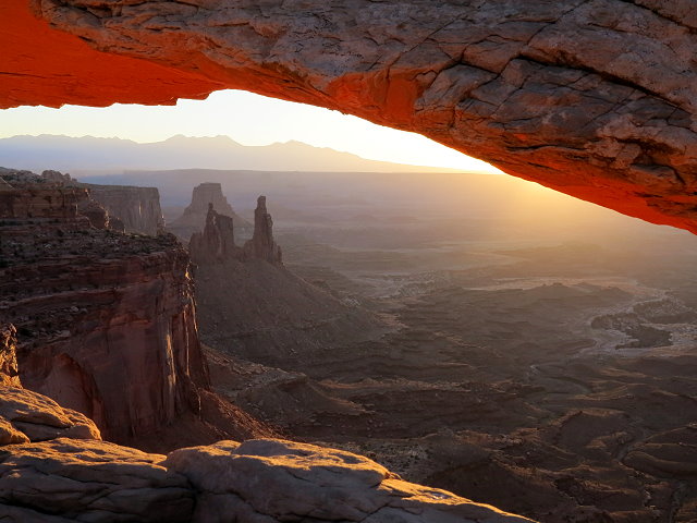
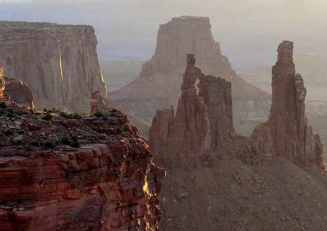
Now I am able to move around a bit and get several shots of the arch and the Washer Woman formation in the background.
Mesa Arch with Washer Woman formation in the background
Close-up of Washer Woman Formation
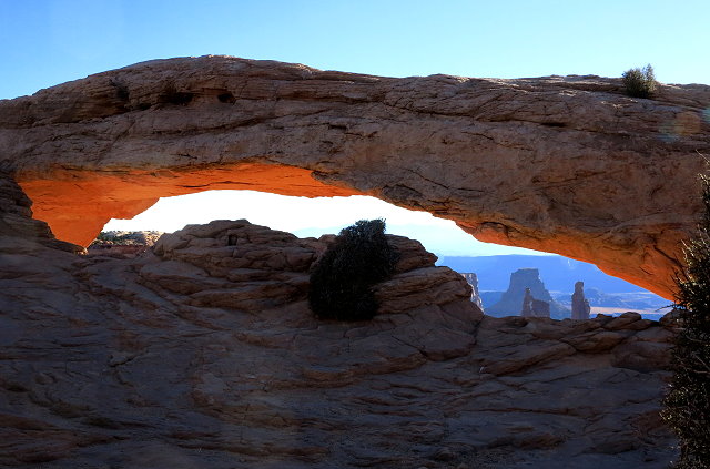
Although I am reluctant to leave, eventually I start the hike back to camp. My cell phone chirps at me; I am surprised and pleased to see that there is enough cell reception here that I am able to see that I have a phone message. I climb up a rock incline away from the trail to listen to the message and then send texts with a cell pic of the arch to my brother and my daughters. After I return the phone call, I call my mom. We have a nice visit until I lose the connection as I’m returning to the parking lot. I decide to explore another trail heading uphill away from the parking lot, hoping for a better cell connection so I can call her back. I discover that this trail leads around to the arch, coming in from a higher vantage point. Not many people are there now, so I go on down to the arch once again. Amazingly, for a few minutes, I am the only person there!
Mesa Arch – I am the only person there!
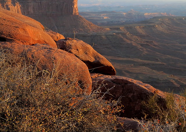
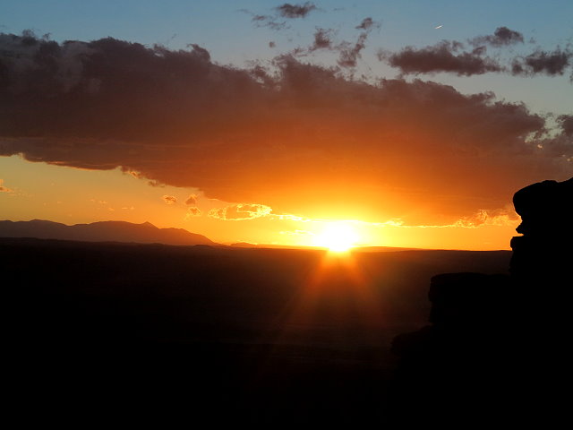
The early morning glow is fading, but to be there in the silence and the beauty of the landscape is priceless. Back at camp, Clifford is feeling worse and spends most of the day in bed. I walk down to the Green River Overlook in the afternoon, and once again, I am the only person witnessing the silence and the beauty of the landscape at this particular point on the planet.
The Green River at sunset
Friday October 21st, Clifford spends the day in bed, while I drive to the visitor’s center for water; mail a postcard of Mesa Arch to Mom so she can see where I was when I called her yesterday. Stop at the Shafter Trail Overview again and Mesa Arch, which is not nearly as dramatic as it is at sunrise.
Shafer Trail Overlook
Back at camp, I download photos and begin editing them. Walk down to the Green River Overlook in time for the sunset.
Sunset at the Green River Overlook
Make soup for dinner, as that is something that Clifford can eat.
Saturday October 22nd, I make a campfire this morning and write in my journal. Clifford is feeling a bit better and up much of the day. We work on projects and tidy up Terry. In the afternoon, I sit outside to play the cello, and later walk down to the Green River Overlook.
Near sunset at the Green River Overlook
We have nachos for dinner and I begin reading “Dances With Wolves.” I saw the movie many years ago, but the book is better.
Monday, October 17th, the mild morning temperature turns cooler as the wind shifts from SW to NW.
The wind shifts, cooler with rain clouds
Leaving Price, the wind does not hamper us, but once we reach I-70, it is problematic.
Leaving Price, Utah
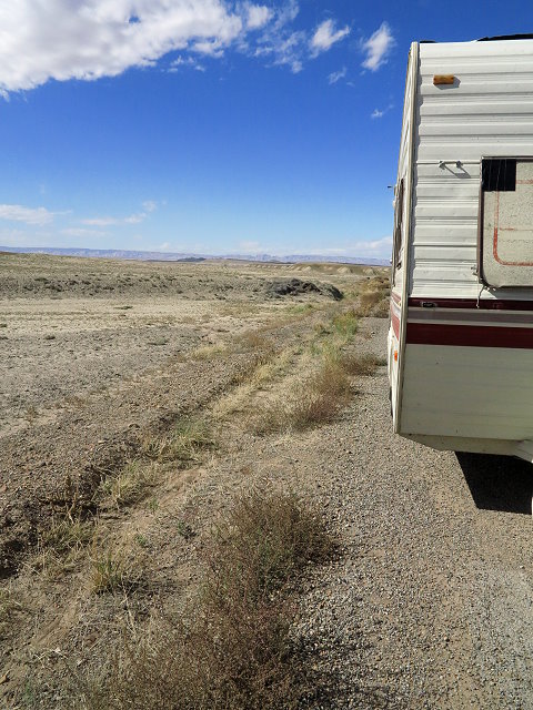
After getting gas at Green River, Utah, we decide to take a frontage road that parallels the highway, since we are having a hard time maintaining interstate speed. Turns out this road is not maintained and it is a very rough ride until we rejoin I-70. At one point we have to stop because the hitch support post slips and hits the ground.
Stop for damage report
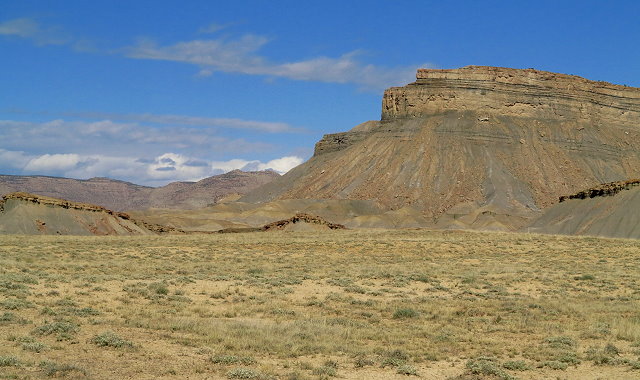
Near the junction with Hwy 191, which will take us south to Moab, we pull into rest stop located on the top of a barren windswept mesa.
Barren and windswept landscape
In spite of the wind, we have a picnic, partially protected by one of the shelters, before we get set up for the night. Quite a switch from last night’s lovely spot.
Tuesday, October 18th, we leave the rest area shortly after 8:00 a.m., as we were advised to be at the Willow Flat Campground in Canyonland National Park by 9:00 a.m.
Heading to Canyonland National Park
It is a small and popular campground that is filled daily by 10:00 a.m. We arrive shortly after 9:00 and are pleased that the first site, a pull-through with a view, is available. The temperature is mild enough that Clifford sits in the sun to study and I am able to play cello outside after we get set up.
Perfect site for us
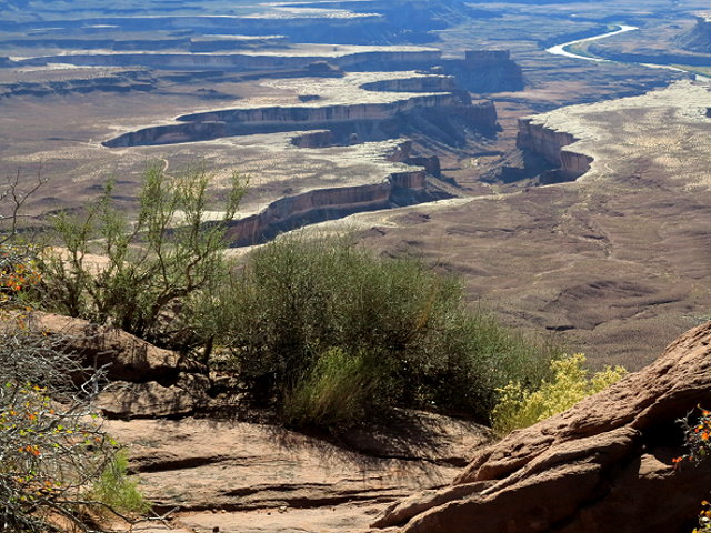
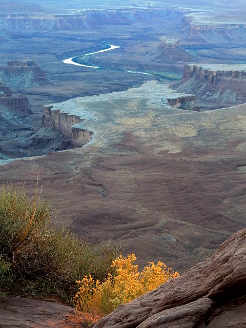
In the afternoon I walk down to the Green River Overlook, a view of the Green River as it cuts its deep meandering channel across the desert.
Green River Overlook
and later Clifford and I walk down in time for photos at sunset.
Green River at sunset
Last rays of the setting sun
Sunset at the Green River Overlook
We are very pleased to be here.
I
Wednesday, October 19th,I make a small campfire this morning, as I especially appreciate the quiet time outdoors before the busy-ness of the day. Today we make a sight-seeing trip to the Shafer Trail Overlook,
Schafer Trail Overlook
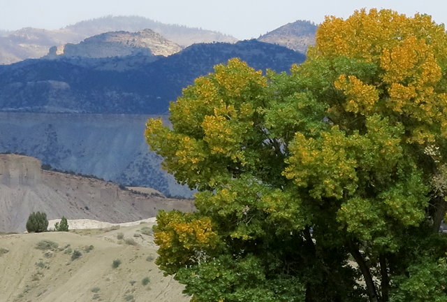
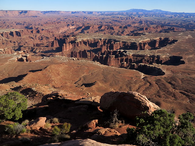
the Grand View Point Overlook,
Grand View Point Overlook
the Orange Cliff view point,
Orange Cliff view point
and then stop for a picnic at the same place we had a picnic last time we were here, over three years ago.
Canyonland picnic area
In the evening, I walk down to the Green River Overview.
Mesa to the east of Willow Flat Campground near sundown
In the neighborhood
Sunset light at Green River Overlook
Clifford has a sore throat this evening, which is not good. We use remedies that we have with us and hope that he feels better tomorrow.
It is still windy this morning, Friday, October 14th, as we leave the rest stop near Anaconda (Montana) and much worse as we head south at Butte. Driving is exhausting and the gas mileage is poor. When we pull into Dillon for gas, we decide to check out the KOA there. Even though it is the most we have ever paid to camp anywhere, in addition to getting out of the wind, we have electricity, free wifi, showers, and laundry facilities. Not only that, it is located right alongside the Beaverhead River and we are surrounded with lawns and trees. I am happy we are spending the night here.
Camped by the Beaverhead River
Surrounded by lawns and trees
Saturday morning, October 15th, while clothes wash and dry, we have showers and breakfast and get packed up. Of course, morning photos of the river are taken.
Morning photos of the Beaverhead River
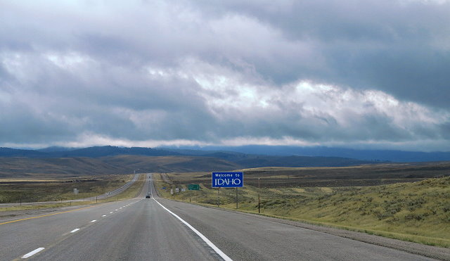
Monida Pass between Montana and Idaho is barren and gradual – much easier on Blazer than the passes east of Butte, which was our route last year.
Entering southern Idaho
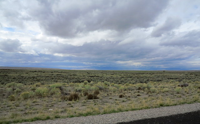
Much of the route across southern Idaho is flat and kind of boring, until we near the border between Idaho and Utah.
Southern Idaho landscape
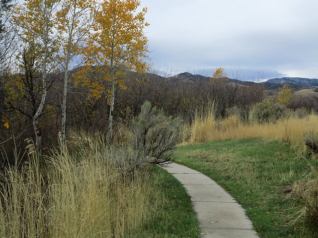
We stop at the last rest stop in Idaho, a sweet spot with lots of trees, walking paths, picnic tables and benches tucked in here and there, and foot bridges over dry stream beds.
Walking paths at a rest stop in southern Idaho
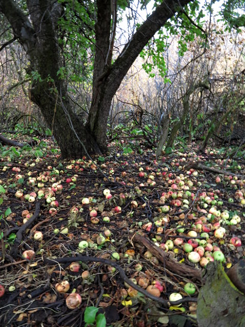
Walking the paths, I discover a huge untended old apple tree; apples that have fallen blanket the ground beneath the tree. I fill my coat pockets with slightly bruised apples, which soon become applesauce.
Old apple tree
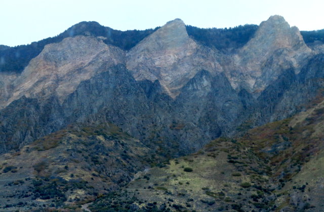
Sunday, October 16th, after a good solid rain in the night, the foot bridges now arch over small streams. I gather more apples. We leave the rest stop and soon are driving in heavy rain in Utah.
Rugged mountains of northern Utah
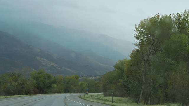
Driving in the rain
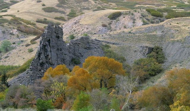
We take I-84 to the east near Ogden, bypassing Salt Lake City. It is a slow, but interesting drive through the canyon country.
Canyon Country
When we reach Price Canyon, we discover that the BLM campground where we had planned to spend the night is off-limits to us. So, on to Price and drive around a bit looking for an inconspicuous place to park a 19-foot camper. On the edge of town, a vacant baseball field parking lot is the perfect spot.