Canada is a big country. If one is going to travel there, where does one start?

Lots of questions remain, but what makes it do-able without a lot of preparation is that southern British Columbia is right next door to northern Idaho were we live, and we have never-before-used passports in hand. Clifford looks into free camping and lots of dots show up on the map, but what does not show up are the roads that lead to the dots. Hmmmm……. Luckily, my friend Ken suggests that a trip along the Kootenay lakes would be close and very scenic. So, in looking at the map, and seeing no dots for free camping in the area of the Kootenay lakes, I look into the provincial parks in the area, jotting down a few notes as to their location, size, and price. We have been talking about making a camping trip to Canada for over a year, while we still lived in New Mexico. Couldn’t pull it off from there, but Idaho opens the door, so to speak, for us.
Wednesday September 3: I have packed enough clothes for a two-week trip, most of the food that we will need, personal items, and the passports. The daypacks, satchels, two coolers, several cameras, briefcases and purse are in a pile by the door. Everything is carefully stowed in the back of the Blazer in the pouring raining. We take extra coats and raingear – who knows, it could rain on our entire trip – but we don’t care. We are going to Canada, rain or shine.
Clifford gets the Pony (our little pop-up tent trailer) hooked up to the Blazer and by early afternoon, we pull out of Wallace, stopping to run errands in Coeur d Alene on the way. By late afternoon, we are at the turn-off to the campground we see on the map south of Sandpoint. It is not a detailed map, but it looks like we should drive several miles east and then south to the shore of Pend Oreille Lake. We come to a junction a few miles in, but stick to the main road. After some time, it becomes apparent that this is not the road that we want to be on. So back to the junction and take other fork, but as we near the lake, it seems that we are on private land with homes along the shore. Hmmm….. With no sign of a campground, we drive all the way back out to the highway and find the nearest gas station where we ask if there really is a campground somewhere out there, which we now have to find in the dark. Someone says “yes,” so we retrace our route, taking the second fork and back down to the lake, and less than a quarter of a mile from where we turned around before, we see the sign to the campground. We head up the steep road and sure enough, there it is. We usually like to check out the sites before picking one, but not tonight. We back into the first available spot that is level enough. We aren’t going to be here long enough to be fussy about it. In order to keep setting up and take-down to a minimum, we don’t unhook the Pony from the Blazer and only pull one bed out part way. This gives us a very limited space to sit as we cook quesadillas with Clifford’s little back-up camp stove and mess kit that he keeps in the topper. Not the most comfortable, but it will save us time in the morning.
Thursday September 4: I wake up not feeling rested, my eyes puffy and bleary. We take the mess kit and camp stove out to the picnic table to heat water to wash up and make tea. The spot we picked in the dark is nice enough and maybe we’ll come again sometime and stay longer. We share a banana and get things repacked and soon we are on our way.
In Sandpoint, we go to a bank and exchange American currency for Canadian currency, a sign of respect for the merchants we will encounter in Canada. At the border, we present our passports and the smiling Canadian border guard asks where we are going and if we have any fruits or vegetables. All that comes to mind are the two slightly wrinkled apples that I put in the cooler, knowing they wouldn’t last until we got home. We are asked to pull forward and dispose of these apples. That takes us by surprise and I think it is a shame to waste good food, even wrinkled apples. Hmmm…… there is more to this story, but not for the public record.

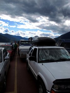
Leaving Creston, we take the wrong road, but soon get ourselves turned around and find ourselves on a wonderfully scenic drive north along the Kootenay Lakes to the ferry crossing at the north end of South Kootenay Lake. The ferry crossing is lovely and fun.

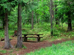
After leaving the ferry, we investigate a nearby provincial park, but deciding it is too civilized and too expensive for our tastes, we retrace our tire tracks (well, sort of) and continue north to Kaslo, a charming little town at a junction that takes us west to New Denver and then north to Rosebery Provincial Park, one of the parks that I had looked into. By now, it is getting to be late afternoon and we are ready to find “home.” We are delighted that this park has lots of available spots and is not as expensive as the others. An absolutely lovely campsite on the end of a loop is available and we are pleased to claim it. We have privacy, a creek nearby, wonderful tall trees including great old cedars, moss covered ground – like
a fairyland – and a steep mountain to guard our backside. Setting up goes smoothly, but I am beat; by time we have a little dinner, I am so tired I can hardly stand up to do the dishes. Bed is ever-so-welcome at our home at Rosebery, British Columbia, Canada.

